MAKE A MEME
View Large Image

| View Original: | World ocean map-fr.gif (500x500) | |||
| Download: | Original | Medium | Small | Thumb |
| Courtesy of: | commons.wikimedia.org | More Like This | ||
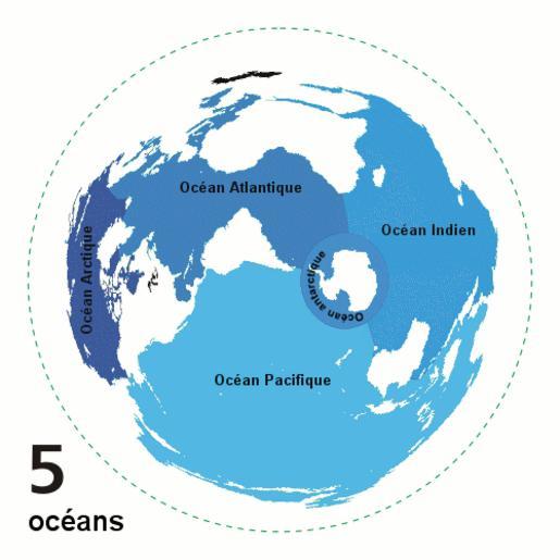
| Keywords: World ocean map-fr.gif Animated world ocean map GIF exhibiting various oceans Azimuthal distance projection map is based on world map from http //www btinternet com/ 7Ese16/js/mapproj htm this online Java tool by Henry Bottomley and altered using CorelDraw/PhotoPaint et al Map is centered on 85° W 45° S rotated 90° CCW North Pole is to the left Ocean boundaries per International Hydrographic Organisation blue ocean black other substantial bodies of water viz Caspian Sea Great Lakes white land green dotted line map periphery Own work french translation of Image World ocean map gif created by User Quizatz Haderach based on Image Oceans png and animated design inspired by Image Continental models gif 2007-10-08 Emmanuel boutet thumb left in english Atelier graphique Animated maps of the world Maps of oceans | ||||