MAKE A MEME
View Large Image

| View Original: | Viborg_Tram_Map.JPG (782x644) | |||
| Download: | Original | Medium | Small | Thumb |
| Courtesy of: | commons.wikimedia.org | More Like This | ||
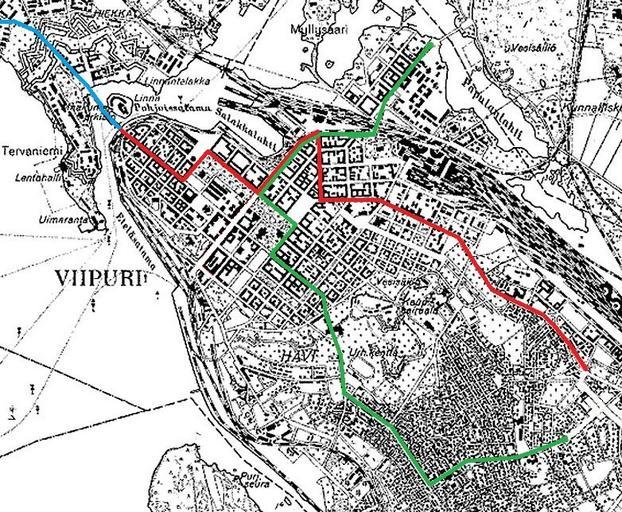
| Keywords: Viborg Tram Map.JPG en Vyborg tram route map in the 1930s Line 1 - red / Line 2 - green / Line 3 - blue fi Viipurin raitoliikenteen linjat 1930-luvulla Linja 1 punainen Raatihuoneentori - Ristimäki / Linja 2 vihreä Papula - Kelkkala / Linja 3 sininen Turun silta - Palotori 1939 Vyborg map 1939 National Land Survey of Finland other versions PD-Art Uploaded with UploadWizard Tram transport in Vyborg Maps of Vyborg Vyborg in the 1930s | ||||