MAKE A MEME
View Large Image

| View Original: | The_Quarterly_journal_of_the_Geological_Society_of_London_(13206129644).jpg (1199x2069) | |||
| Download: | Original | Medium | Small | Thumb |
| Courtesy of: | commons.wikimedia.org | More Like This | ||
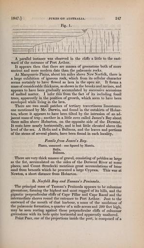
| Keywords: The Quarterly journal of the Geological Society of London (13206129644).jpg 1847 JUKES ON AUSTRALIA 247 <br> Fig 1 <br> fni'ii ivifii i \i <br> A parallel instance was observed in the cliffs a little to the east- <br> ward of the entrance of Port Arthur <br> It appears then that there are masses of greenstone both of more <br> ancient and more modern date than the palaeozoic rocks <br> At Macquarrie Plains about ten miles above New Norfolk there is <br> a large exhibition of igneous rock which from its cellular character <br> seems certainly to have flowed as lava in the open air It forms a <br> mass of considerable thickness as shown in the brooks and ravines and <br> appears to have been gradually accumulated by successive accessions <br> of melted matter I infer this from the fact of its including fossil <br> trees apparently in the position of growth which seem to have been <br> enveloped while living in the lava <br> There are two small patches of tertiary travertinous limestones <br> one mentioned by Mr Darwin and found in the outskirts of Hobar- <br> ton where it appears to have been tilted by the intrusion of an ad- <br> jacent mass of trap ; another in a little cove called James's Bay about <br> three miles above Hobarton on the opposite side of the Derwent <br> It rests here nearly horizontally and is but little elevated above the <br> level of the sea A Helix and a Bulimus and the leaves and portions <br> of the stems of several plants have been found in each locality <br> Fossils from Jameses Bay <br> Plants unnamed one figured by Morris <br> Helix <br> Bulimus <br> There are very thick masses of gravel consisting of pebbles as large <br> as the fist accumulated on the sides of the Derwent River at some <br> places and Count Strzelecki mentions great accumulations of loose <br> sand from beneath which he procured a large Cyprsea This was at <br> Newton a short distance from Hobarton <br> B Norfolk Bay and TasmarHs Peninsula <br> The principal mass of Tasman's Peninsula appears to be columnar <br> greenstone forming the highest and most rugged of its hills and the <br> gigantic perpendicular chffs of Cape Pillar and Cape Baoul and the <br> intermediate shores round the entrance to Port Arthur Just to the <br> eastward of the mouth of that harbour a mass of the sandstone of <br> the palaeozoic formation a quarter of a mile across and 200 feet high <br> may be seen resting against these perpendicular cliffs of columnar <br> greenstone with its beds quite horizontal and apparently unaltered <br> Point Puer one of the projections inside the port is composed of a 36932986 113687 51125 Page 247 Text v 3 http //www biodiversitylibrary org/page/36932986 1847 Geological Society of London NameFound Bulimus NameConfirmed Bulimus EOLID 4890202 NameBankID 4096770 NameFound Puer NameConfirmed Puer EOLID 4129539 NameBankID 4323796 Biodiversity Heritage Library The Quarterly journal of the Geological Society of London v 3 1847 Geology Periodicals Smithsonian Libraries bhl page 36932986 dc identifier http //biodiversitylibrary org/page/36932986 smithsonian libraries Information field Flickr posted date ISOdate 2014-03-17 Check categories 2015 August 26 CC-BY-2 0 BioDivLibrary https //flickr com/photos/61021753 N02/13206129644 2015-08-26 12 51 47 cc-by-2 0 PD-old-70-1923 The Quarterly journal of the Geological Society of London 1847 Photos uploaded from Flickr by Fæ using a script | ||||