MAKE A MEME
View Large Image

| View Original: | The_Quarterly_journal_of_the_Geological_Society_of_London_(12645343973).jpg (1192x1999) | |||
| Download: | Original | Medium | Small | Thumb |
| Courtesy of: | commons.wikimedia.org | More Like This | ||
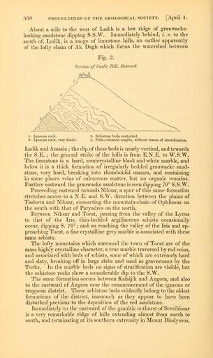
| Keywords: The Quarterly journal of the Geological Society of London (12645343973).jpg 368 <br> PROCEEDINGS OF THE GEOLOGICAL SOCIETY April 4 <br> About a mile to the west of Ladik is a low ridge of grauwacke- <br> looking sandstone dipping S S W Immediately behind i e to the <br> south of Ladik is a range of limestone hills an outUer apparently <br> of the lofty chain of Ak Dagh which forms the watershed between <br> Fig 2 <br> Section of Castle Hill Boiavad <br> -A <br> 1 Igneous rock <br> 2 Igneous rock very fissile <br> 3 Schistose beds contorted <br> 4 Pink-coloured scaglia without traces of stratification <br> Ladik and Amasia ; the dip of these beds is nearly vertical and towards <br> the S E ; the general strike of the hills is from E N E to W S W <br> The limestone is a hard semicrystalline black and white marble and <br> below it is a thick formation of irregularly bedded grauwacke sand- <br> stone very hard breaking into rhomboidal masses and containing <br> in some places veins of calcareous matter but no organic remains <br> Further eastward the grauwacke sandstone is seen dipping 70° S S W <br> Proceeding eastward towards Niksar a spur of this same formation <br> stretches across in a N E and S W direction between the plains of <br> Tashova and Niksar connecting the mountain-chain of Ophlimus on <br> the south with that of Paryadres on the north <br> Between Niksar and Tocat passing from the valley of the Lycus <br> to that of the Iris thin-bedded argillaceous schists occasionally <br> occur dipping S 70° ; and on reaching the valley of the Iris and ap- <br> proaching Tocat a fine crystalline grey marble is associated with these <br> same schists <br> The lofty mountains which surround the town of Tocat are of the <br> same highly crystalline character a true marble traversed by red veins <br> and associated with beds of schists some of which are extremely hard <br> and slaty breaking oif in large slabs and used as gravestones by the <br> Turks In the marble beds no signs of stratification are visible but <br> the schistose rocks show a considerable dip to the S W <br> The same formation occurs between Kalaijik and Angora and also <br> to the eastward of Angora near the commencement of the igneous or <br> trappean district These schistose beds evidently belong to the oldest <br> formations of the district inasmuch as they appear to have been <br> disturbed previous to the deposition of the red sandstone <br> Immediately to the eastward of the granitic outburst of Sevrihissar <br> is a very remarkable ridge of hills extending almost from north to <br> south and terminating at its southern extremity in Mount Dindymus 35269018 109512 51125 Page 368 Text v 5 http //www biodiversitylibrary org/page/35269018 1849 Geological Society of London NameFound Amasia NameConfirmed Amasia NameBankID 4064554 NameFound Dindymus NameConfirmed Dindymus NameBankID 4144006 NameFound Lycus NameConfirmed Lycus EOLID 110488 NameBankID 3002239 Biodiversity Heritage Library The Quarterly journal of the Geological Society of London v 5 1849 Geology Periodicals Smithsonian Libraries bhl page 35269018 dc identifier http //biodiversitylibrary org/page/35269018 smithsonian libraries Information field Flickr posted date ISOdate 2014-02-20 Check categories 2015 August 26 CC-BY-2 0 BioDivLibrary https //flickr com/photos/61021753 N02/12645343973 2015-08-27 10 54 16 cc-by-2 0 PD-old-70-1923 The Quarterly journal of the Geological Society of London 1849 Photos uploaded from Flickr by Fæ using a script | ||||