MAKE A MEME
View Large Image

| View Original: | The_Quarterly_journal_of_the_Geological_Society_of_London_(14076469775).jpg (1192x2078) | |||
| Download: | Original | Medium | Small | Thumb |
| Courtesy of: | commons.wikimedia.org | More Like This | ||
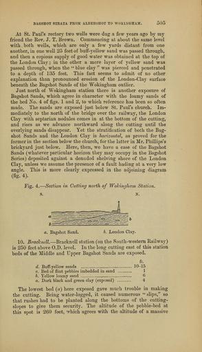
| Keywords: The Quarterly journal of the Geological Society of London (14076469775).jpg BAGSHOT STRATA FROM ALDERSHOT TO WOKINGHAM 505 <br> At St Paul's rector ' two wells were dug a few years ago by my <br> friend the E-ev J T Brown Commencing at about the same level <br> with both wells which are only a few yards distant from one <br> another in one well 25 feet of butf-yellow sand was passed through <br> and then a copious su 3ply of good water was obtained at the top of <br> the London Clay ; in the other a mere layer of yellow sand was <br> passed through when the blue clay was pierced and penetrated <br> to a depth of 135 feet This fact seems to admit of no other <br> explanation than pronounced erosion of the Loudon-Clay surface <br> beneath the Bagshot Sands of the Wokingham outlier <br> Just north of Wokingham station there is another exposure of <br> Bagshot Sands which agree in character with the loamy sands of <br> the bed jS'o 4 of figs 1 and 2 to which reference has been so often <br> made The sands are exposed just below St Paul's church Im- <br> mediately to the north of the bridge over the railway the London <br> Clay with septarian nodules comes in at the bottom of the cutting <br> and rises as we advance northward along the cutting until the <br> overlying sands disappear Yet the stratification of both the Bag- <br> shot Sands and the London Clay is horizontal as proved for the <br> former in the section below the church for the latter in Mr Phillips's <br> brickyard just below Here then we have a case of the Bagshot <br> Sands whatever particular horizon they may occupy in the Bagshot <br> Series deposited against a denuded shelving shore of the London <br> Clay unless we assume the presence of a fault hading at a very low <br> angle This is more clearly expressed in the adjoining diagram <br> fig 4 <br> Pig 4 Section in Cutting north of Wohingham Station <br> S S <br> a Bagshot Sand b London Olay- <br> 10 Bracknell Bracknell station on the South-western Railway <br> is 250 feet above O D level In the long cutting east of this station <br> beds of the Middle and L pper Bagshot Sands are exposed <br> ft <br> ÂŁ Buff-yellow sands 10-15 <br> c Bed of flint pebbles imbedded in sand 1 <br> b Yellow loamy sand 6 <br> a Dark black and green clay exposed 4 <br> The lowest bed a here exposed gave much trouble in making <br> the cutting Being water-logged it caused numerous slips so <br> that rushes had to be planted along the bottoms of the cutting- <br> slopes to give them security The altitude of the pebble-bed at <br> this spot is -260 feet which agrees with the altitude of a massive 37047383 114009 51125 Page 505 Text 41 http //www biodiversitylibrary org/page/37047383 1885 Geological Society of London Biodiversity Heritage Library The Quarterly journal of the Geological Society of London v 41 1885 Geology Periodicals Smithsonian Libraries bhl page 37047383 dc identifier http //biodiversitylibrary org/page/37047383 smithsonian libraries Information field Flickr posted date ISOdate 2014-04-30 Check categories 2015 August 26 CC-BY-2 0 BioDivLibrary https //flickr com/photos/61021753 N02/14076469775 2015-08-26 04 51 17 cc-by-2 0 PD-old-70-1923 The Quarterly journal of the Geological Society of London 1885 Photos uploaded from Flickr by FĂŚ using a script | ||||