MAKE A MEME
View Large Image
| View Original: | Seattle_waterways_-_1990s.jpg (1916x2447) | |||
| Download: | Original | Medium | Small | Thumb |
| Courtesy of: | commons.wikimedia.org | More Like This | ||
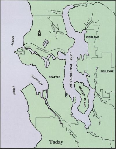
| Keywords: Seattle waterways - 1990s.jpg Map of waterways in and around Seattle Washington as they were in the 1990s still accurate 2011 scanned at 600 dpi and cleaned up U S Government Printing Office Pamphlet 1999-791-887 Lake Washington Ship Canal and Hiram M Chittenden Locks p 3 Presumably 1999 based on pamphlet number US government Original work of the US Federal Government is public domain Image Seattle waterways - 1902 jpg is intended to be contrasted to Image Seattle waterways - 1990s jpg and shows the effect of the Lake Washington Ship Canal Maps of Seattle Lake Washington Ship Canal Maps made in the 20th century Drainage basin maps of North America PD-USGov | ||||