MAKE A MEME
View Large Image
| View Original: | Seattle_waterways_-_1902.jpg (1967x2451) | |||
| Download: | Original | Medium | Small | Thumb |
| Courtesy of: | commons.wikimedia.org | More Like This | ||
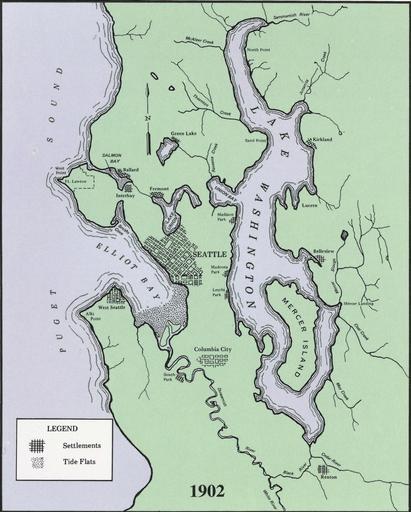
| Keywords: Seattle waterways - 1902.jpg Map of waterways in and around Seattle Washington as they were in 1902 scanned at 600 dpi and cleaned up U S Government Printing Office Pamphlet 1999-791-887 Lake Washington Ship Canal and Hiram M Chittenden Locks p 3 Presumably 1999 based on pamphlet number US government Original work of the US Federal Government is public domain Image Seattle waterways - 1902 jpg is intended to be contrasted to Image Seattle waterways - 1990s jpg and shows the effect of the Lake Washington Ship Canal Maps of Seattle Lake Washington Ship Canal 1902 maps PD-USGov | ||||