MAKE A MEME
View Large Image

| View Original: | Riverslosangeles.jpg (1739x1691) | |||
| Download: | Original | Medium | Small | Thumb |
| Courtesy of: | commons.wikimedia.org | More Like This | ||
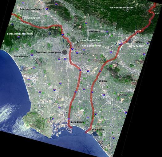
| Keywords: Riverslosangeles.jpg Map of the en Los Angeles Basin with the Los Angeles River and San Gabriel River highlighted in red ladge NASA original 2005-10-02 <br/> original text 1 en 2005-10-05 en User Mikeetc The overlying work is by me Underlying map is an aerial map obtained from http //earthobservatory nasa gov/Newsroom/NewImages/images php3 img_id 5118 NASA original PD-USGov Mikeetc original upload log page en wikipedia Riverslosangeles jpg 2005-10-02 11 07 Mikeetc 1739×1691× 3632156 bytes <nowiki>Map of the Los Angeles Basin with the Los Angeles and San Gabriel Rivers highlighted in red Underlying map is an aerial map obtained from NASA original http //earthobservatory nasa gov/Newsroom/NewImages/images php3 img_id 5118 The overlying work is by </nowiki> 2005-10-02 05 28 Mikeetc 1739×1691× 3631971 bytes <nowiki>Map of the Los Angeles Basin with the Los Angeles and San Gabriel Rivers highlighted in red Underlying map is an aerial map obtained from NASA original http //earthobservatory nasa gov/Newsroom/NewImages/images php3 img_id 5118 The overlying work is b</nowiki> Los Angeles Basin Satellite pictures of California Los Angeles River 05 San Gabriel River California 05 Geography of Los Angeles County California Maps of Orange County California | ||||