MAKE A MEME
View Large Image
| View Original: | Pictorial_map_of_the_city_of_Paris_and_its_environs.jpg (8205x6195) | |||
| Download: | Original | Medium | Small | Thumb |
| Courtesy of: | commons.wikimedia.org | More Like This | ||
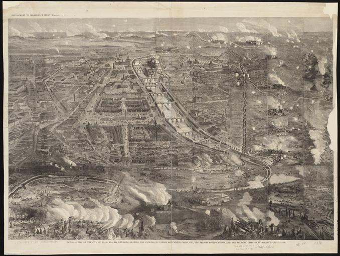
| Keywords: Pictorial map of the city of Paris and its environs.jpg Map of Paris 1871 Size cm 75 52 Institution Boston Public Library object history exhibition history credit line http //maps bpl org/id/10897 Norman B Leventhal Map Center accession number G5834 P3A3 1871 P5 PD-100 Images from the Norman B Leventhal Map Center Siege of Paris 1870-1871 Bird's-eye views of Paris 1871 in Paris Maps of fortifications in Paris Historical views of the Seine in Paris Historical aerial views of the Louvre 1871 Remote views of the Palais des Tuileries Palais Brongniart Historical images of Jardin des Tuileries Historical images of Rue de Rivoli Paris 1871 Île de la Cité in art Remote views of Notre-Dame de Paris Historical images of Panthéon de Paris Historical images of Palais Bourbon Remote views of Palais Bourbon Historical images of Place de la Concorde Notre-Dame de Paris on the maps 1871 Avenue des Champs-Élysées in the 1870s Historical images of the Jardins des Champs-Élysées 1870 Arc de Triomphe de l'Étoile in the 1870s Historical images of Église de la Madeleine Palais de l'Industrie Historical images of Les Invalides Pictorial maps of Paris Arc de Triomphe de l'Étoile from above Arc de Triomphe de l'Étoile from the northwest before 2000 Notre-Dame de Paris in the 1870s fortifications in Paris | ||||