MAKE A MEME
View Large Image
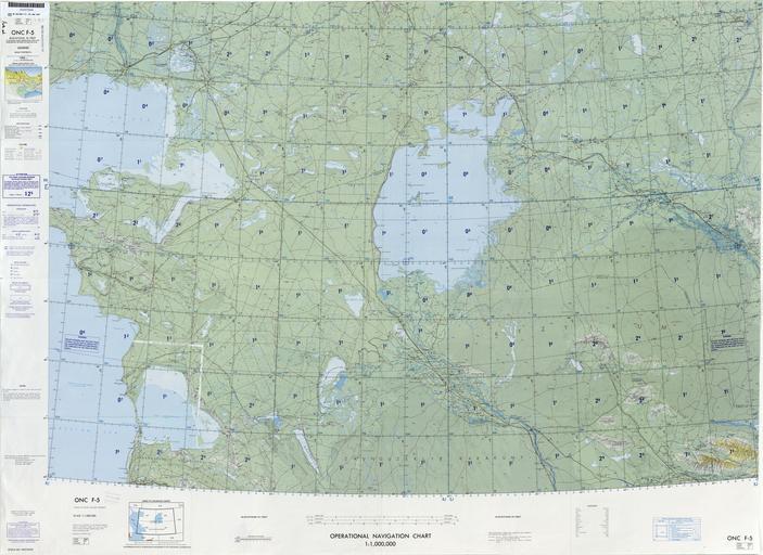
| View Original: | Operational_Navigation_Chart_F-5,_6th_edition.jpg (9254x6742) | |||
| Download: | Original | Medium | Small | Thumb |
| Courtesy of: | commons.wikimedia.org | More Like This | ||
| Keywords: Operational Navigation Chart F-5, 6th edition.jpg 1 1 000 000 scale Operational Navigation Chart Sheet F-5 6th edition Covers USSR Lambert Conformal Conic Projection Standard Parallels 41 20N and 46 40N Center longitude 59E 1980-05 txu-pclmaps-oclc-8322829_f_5 jpg onc/ Defense Mapping Agency Aerospace Center St Louis Air Force Station Mo Covers 40N to 48N 51E to 67E PD-USGov ONCs uploaded by Revent Operational Navigation Chart Maps of the Soviet Union Maps with Lambert conformal conic projection JPG maps Operational Navigation Charts in the Perry-Castañeda Library | ||||