MAKE A MEME
View Large Image
| View Original: | Old_Mines_concession_plat_survey.jpg (1579x2461) | |||
| Download: | Original | Medium | Small | Thumb |
| Courtesy of: | commons.wikimedia.org | More Like This | ||
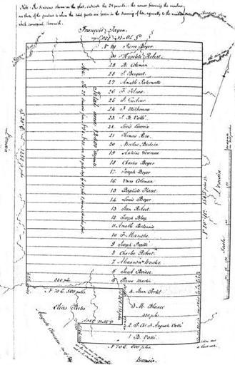
| Keywords: Old Mines concession plat survey.jpg Old Mines land concession with the original owners of each plot shown by surveyor Thomas Maddin Schroeder Walter A 2002 Opening the Ozarks; A Historical Geography of Missouri's Ste Genevieve District 1760-1830 p 312 Thomas Maddin surveyor 1803 PD-Old-100 Old Mines Missouri | ||||