MAKE A MEME
View Large Image

| View Original: | Ohio Lands.svg (323x364) | |||
| Download: | Original | Medium | Small | Thumb |
| Courtesy of: | commons.wikimedia.org | More Like This | ||
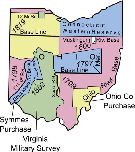
| Keywords: Ohio Lands.svg SOURCE http //nationalatlas gov/articles/boundaries/IMAGES/plssohio gif Plssohio gif 2008-05-30 04 54 UTC derivative work Andy85719 Plssohio gif Original uploader was Jengod at http //en wikipedia org en wikipedia Created SVG version of the Ohio Land map Inkscape Plssohio gif original upload log This image is a derivative work of the following images Image Plssohio gif licensed with PD-USGov-Atlas 2007-04-19T11 35 00Z Liftarn 350x379 48222 Bytes <nowiki> page is/was http //en wikipedia org/w/index php</nowiki> Uploaded with derivativeFX Ohio Lands Geography of Ohio SVG maps of Ohio Military history of the United States Cadastral maps of the United States Maps of the history of Ohio Ohio Territory Maps of former territories of the United States | ||||