MAKE A MEME
View Large Image

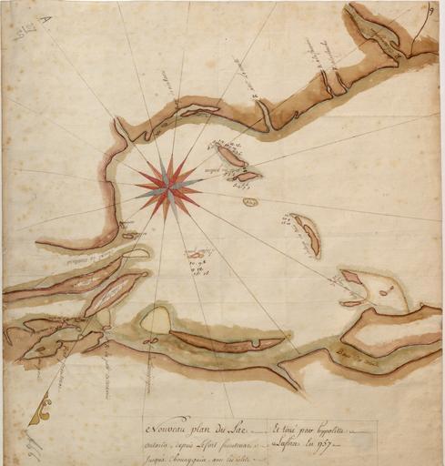
| View Original: | Nouveau_plan_du_lac_Ontario_depuis_le_fort_Frontenac_jusqu'a_Chouayguin.jpg (4700x4924) | |||
| Download: | Original | Medium | Small | Thumb |
| Courtesy of: | commons.wikimedia.org | More Like This | ||
| Keywords: Nouveau plan du lac Ontario depuis le fort Frontenac jusqu'a Chouayguin.jpg fr Nouveau plan du Lac ontario depuis Le fort frontenac jusquà Chouayguin avec les isles Et Bancs qui y Sont en Author Laforce René-Hippolyte<br> Date 1757<br> Location Ontario Lake N Y and Ont <br> Dimensions 43 x 39 cm<br> Scale Scale not given<br> Reference Titled 'Nouveau plan du Lac Ontario depuis le fort Frontenac jusqu'ai Chouayguin par Hypolitte Laforce en 1757' No scale given Map oriented with North-North-West at top French Amherst no 1 66 R U S I no A 27 29 425 x 390 mm in The British Library catalogue of additions to the manuscripts new series 1971-1975<br> Call Number From the British Library Add MS 57707 9 1757 http //maps bpl org/id/n51826 Laforce René-Hippolyte other versions PD-old-70-1923 Lake Ontario Ontario in the 1750s Fort Frontenac Fort Ontario Fort Oswego Uploaded with UploadWizard | ||||