MAKE A MEME
View Large Image
| View Original: | Northumbria 802.jpg (1800x2218) | |||
| Download: | Original | Medium | Small | Thumb |
| Courtesy of: | commons.wikimedia.org | More Like This | ||
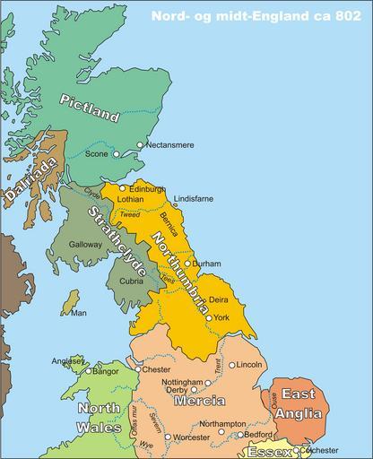
| Keywords: Northumbria 802.jpg Kart over midt- og nord-England spesielt Northumbria rundt år 802 Map of middle and northern England centred around Northumbria circa 802 My own drawing drawn in CorelDraw12 source file available on request or in different file formats 2006-10-19 Finn the uploader PD Maps of Anglo-Saxon England Maps of the history of Scotland Maps showing 9th-century history | ||||