MAKE A MEME
View Large Image

| View Original: | Northern_and_central_Italy_in_1860.jpg (611x705) | |||
| Download: | Original | Medium | Small | Thumb |
| Courtesy of: | commons.wikimedia.org | More Like This | ||
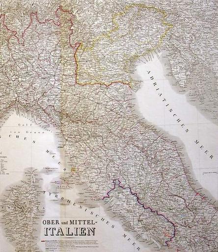
| Keywords: Northern and central Italy in 1860.jpg en Map of northern and central Italy showing the territorial changes brought about by the upheavals of 1859-60 Austria has lost Lombardy but still retains Venetia bordered in yellow while the Papal States bordered in purple have been reduced to their core provinces the so-called Patrimony of Saint-Peter and the Latium respectively northwest and southeast of Rome Cropped from a map of northern and central Italy by Heinrich Kiepert 1860 2013-04-07 10 10 51 http //www oldmapgallery com/catalog/product_info php manufacturers_id 210 products_id 1324 osCsid 01d586f19705e776e3949d754ab10d4e Heinrich Kiepert 1860 PD-old-70 Uploaded with UploadWizard Maps of the Papal States | ||||