MAKE A MEME
View Large Image
| View Original: | Napkelet_Vallási_térkép.JPG (2048x1536) | |||
| Download: | Original | Medium | Small | Thumb |
| Courtesy of: | commons.wikimedia.org | More Like This | ||
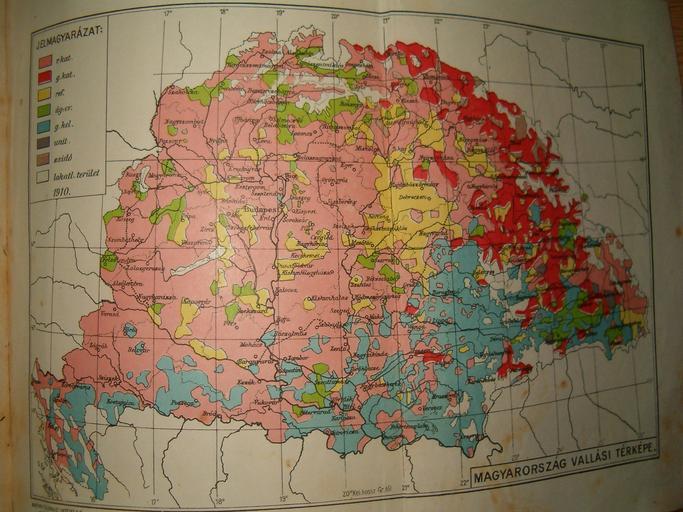
| Keywords: Napkelet Vallási térkép.JPG Territorial distribution of religions in Great Hungary 1928 Map from The Lexicon of Napkelet PD-old Religion maps of Hungary | ||||