MAKE A MEME
View Large Image

| View Original: | Myrareldar.svg (621x723) | |||
| Download: | Original | Medium | Small | Thumb |
| Courtesy of: | commons.wikimedia.org | More Like This | ||
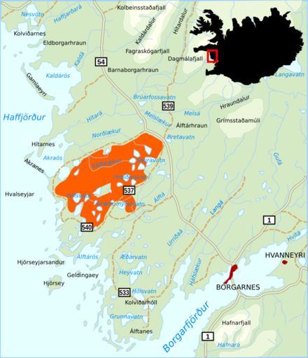
| Keywords: Myrareldar.svg Map of the region Myrar in western Iceland with several toponyms and colored the area affected by the fires of April 2006 own 2007-04-20 Akigka <gallery> Image Myrar svg Showing Myrar with roads and major toponyms Image Myrar_hnokki svg Showing the place where the Pourquoi-pas stranded in 1936 </gallery> Maps of Iceland Borgarbyggð History of Iceland Fires in Iceland Maps of West-Iceland April 2006 in Iceland | ||||