MAKE A MEME
View Large Image

| View Original: | Melchisédech_Thévenot._Carte_de_la_Colchide_appelée_maintenant_Mengrelie,_et_par_ceux_du_pays,_Odisci.jpg (3344x2337) | |||
| Download: | Original | Medium | Small | Thumb |
| Courtesy of: | commons.wikimedia.org | More Like This | ||
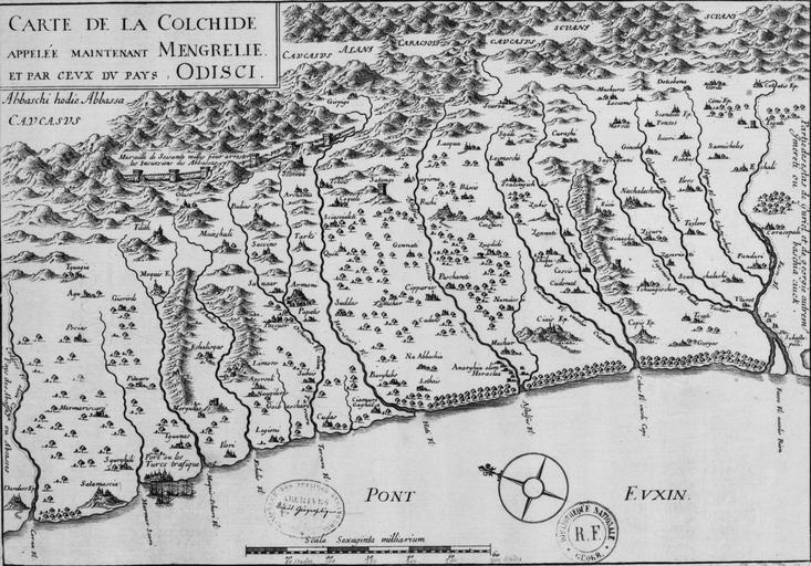
| Keywords: Melchisédech Thévenot. Carte de la Colchide appelée maintenant Mengrelie, et par ceux du pays, Odisci.jpg Artwork Creator Melchisédech Thévenot fr Melchisédech Thévenot Carte de la Colchide appelée maintenant Mengrelie et par ceux du pays Odisci en An early map showing the extent of the fortifications of the Ottoman Empire along the east of the Black Sea and in the foothills of the Caucasus Vignettes of buildings mountains and ships in harbour Published in Paris - 1660 1679 1683 cm 36 49 Institution Bibliothèque nationale de France Paris accession number CPL GE DD-2987 6570 object history Collection d'Anville credit line ark /12148/btv1b5900249k/f1 item r http //www antiqueatlas com/shop asp action details inventoryID 120412 catId 14010 www antiqueatlas com PD-GallicaScan PD-Art-100 ImageNote 1 882 1794 100 117 3344 2337 2 Ilori ImageNoteEnd 1 ImageNote 2 1948 966 159 130 3344 2337 2 Zugdidi Zugdidi ImageNoteEnd 2 ImageNote 3 477 548 619 146 3344 2337 2 Muraille de Soisante milles pour arrester les Incursions des Abbassas ImageNoteEnd 3 ImageNote 4 13 334 518 92 3344 2337 2 Abbaschi hodie Abbasa ImageNoteEnd 4 ImageNote 5 2278 50 192 117 3344 2337 2 Scvani ImageNoteEnd 5 ImageNote 6 2897 33 201 84 3344 2337 2 Scvani ImageNoteEnd 6 ImageNote 7 1404 155 163 75 3344 2337 2 Alani ImageNoteEnd 7 ImageNote 8 3106 305 209 105 3344 2337 2 Cotais ImageNoteEnd 8 ImageNote 9 3143 1271 84 63 3344 2337 2 Puti Poti ImageNoteEnd 9 Melchisédech Thévenot Maps of Colchis Old maps of Samegrelo Maps of the history of Abkhazia 17th-century maps of Georgia Maps made in the 17th century Great Abkhazian Wall | ||||