MAKE A MEME
View Large Image
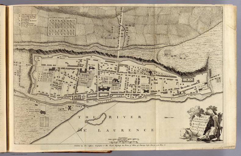
| View Original: | Map of Montreal (1758) by Thomas Jefferys.jpg (8251x5346) | |||
| Download: | Original | Medium | Small | Thumb |
| Courtesy of: | commons.wikimedia.org | More Like This | ||
| Keywords: Map of Montreal (1758) by Thomas Jefferys.jpg of Canada and Louisiana London Printed for Thomas Jefferys at Charing-Cross MDCCLX Pub Reference Howes J83; Streeter 128; Sabin 35964; P-Maps lists all 18 maps ; Stevens and Tree 27 b 51 a 66 b ; Clark I 263; Ristow p25-28 Samuel Holland Pub Note See note field above Pub List No 4796 000 Pub Type Geography Book Pub Maps 18 Pub Height cm 36 Pub Width cm 23 Image No 4796003 Download 1 Full Image Download ¦ Download 2 GeoViewer for JP2 a ¦ Collection Rumsey Collection Creator Thomas Jefferys PD-old-70-1923 Old maps of Canada 1758 maps Old maps of New France Old maps of Quebec Ville-Marie Maps made in the 18th century Thomas Jefferys Maps of Montreal City walls in Canada | ||||
-by-Thomas-Jefferys.jpg)