MAKE A MEME
View Large Image

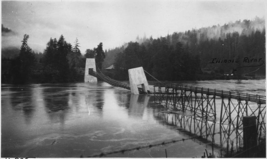
| View Original: | Looking_south_from_north_bank._At_9_am,_Feb._20,_1927,_one_hour_after_Pier_"C"_shirfted._Six_trestle_bents_washed_out..._-_NARA_-_298243.jpg (3000x1789) | |||
| Download: | Original | Medium | Small | Thumb |
| Courtesy of: | commons.wikimedia.org | More Like This | ||
| Keywords: Looking south from north bank. At 9 am, Feb. 20, 1927, one hour after Pier "C" shirfted. Six trestle bents washed out... - NARA - 298243.jpg Scope and content Angess Bridge over Rogue River in Siskiyou National Forest General notes 298243 Local identifier Department of Commerce Bureau of Public Roads Portland Regional Office 08/20/1949 - ca 1955 NARA's Pacific Alaska Region Seattle NRIAS 6125 Sand Point Way NE Seattle WA 98115-7999 1927-02-20 Record group Record Group 30 Records of the Bureau of Public Roads 1892 - 1972 Record group ARC 359 Federal Aid Project Files compiled 1919 - 1955 Series ARC 298240 File unit Angess Bridge over Rogue River Siskiyou National Forest ca 1927 - ca 1927 File unit ARC 298241 Variant control numbers NAIL Control Number NRIS-30-PORTFAP-OR486-14538 Other versions <gallery> File Looking_south_from_north_bank _At_9_am _Feb _20 _1927 _one_hour_after_Pier_ C _shirfted _Six_trestle_bents_washed_out _-_NARA_-_298243 tif tif File Looking_south_from_north_bank _At_9_am _Feb _20 _1927 _one_hour_after_Pier_ C _shirfted _Six_trestle_bents_washed_out _-_NARA_-_298243 jpg jpg </gallery> NARA-cooperation PD-USGov Damaged bridges Oregon Suspension bridges in Oregon Rogue Rogue River Oregon 1927 in Oregon February 1927 Rogue River-Siskiyou National Forest Rogue NARA images of Oregon bridge Black and white photographs of Oregon bridge Damaged infrastructure | ||||