MAKE A MEME
View Large Image

| View Original: | Leonhard_Euler_World_Map_AD1760.jpg (2615x2252) | |||
| Download: | Original | Medium | Small | Thumb |
| Courtesy of: | commons.wikimedia.org | More Like This | ||
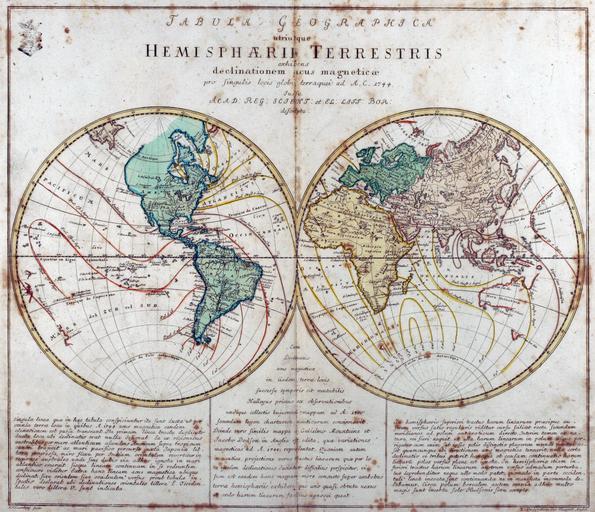
| Keywords: Leonhard Euler World Map AD1760.jpg Tabula Geographica utriusque Hemisphaerii Terrestris exhibens declinationem acus magneticae pro singulis locis globi terraquei ad A C 1744 Iussu Acad Reg Scient et El Litt Bor descripta de Kupferstich-Weltkarte von Leonhard Euler aus seinem Schulatlas Geographischer Atlas bestehend in 44 Land-Charten erstmals 1753 in Berlin erschienen en Engraved world map including magnetic declination lines by Leonhard Euler from his school atlas Geographischer Atlas bestehend in 44 Land-Charten first published 1753 in Berlin Antique-World http //www vintage-map com/en/Atlases/Euler-Atlas-1760 82 html Antique World Map by Leonhard Euler 1760 Creator Leonhard Euler Own work PD-old-100-1923 Magnetic field maps of the world 1760 maps 1760s maps of the world Double hemisphere world maps Old maps of Earth's hemispheres Global maps centered Ferro meridian Leonhard Euler | ||||