MAKE A MEME
View Large Image

| View Original: | Le royaume des Francs en 561.svg (754x783) | |||
| Download: | Original | Medium | Small | Thumb |
| Courtesy of: | commons.wikimedia.org | More Like This | ||
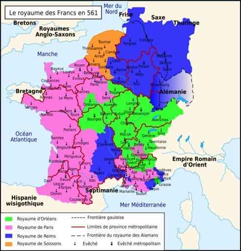
| Keywords: Le royaume des Francs en 561.svg fr Le royaume des Francs en 561 Travail personnel sur un fond de carte de historicair Image Blank map of Gaul 1st century BC svg D'après Paul Vidal de La Blache Gaule à la mort de Clotaire 561 Image Division of Gaul - 561 jpg Atlas général d'histoire et de géographie 1894 Frédéric Armand Chilpéric Ier La Louve éditions 2008 p 77 et Bruno Dumézil La reine Brunehaut éditions Fayard 2008 p 536 Romain0 2010-03-14 Le royaume des Francs en 561 ru svg Maps of the Merovingian territory Maps of the Frankish territory Maps of Gauls Maps showing 6th-century history SVG maps showing history in French | ||||