MAKE A MEME
View Large Image
| View Original: | KAARTEN SGD - Uitbreiding van de visschershaven te IJmuiden.jpeg (3972x1958) | |||
| Download: | Original | Medium | Small | Thumb |
| Courtesy of: | commons.wikimedia.org | More Like This | ||
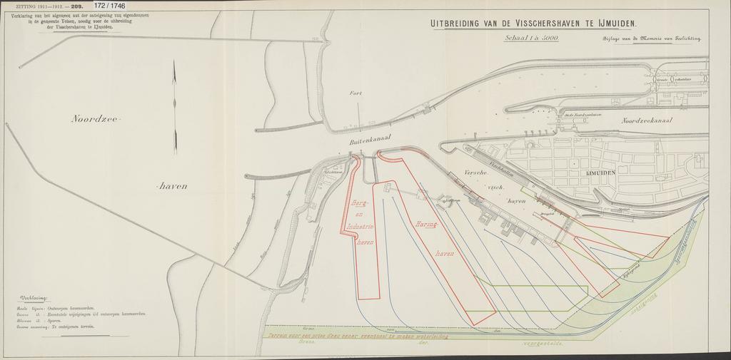
| Keywords: KAARTEN SGD - Uitbreiding van de visschershaven te IJmuiden.jpeg accession number en The individual creators of this map are unknown it was commissioned by the House of Representatives of the Netherlands Op de kaart is tevens het terrein aangegeven waar eventueel een waterleiding gemaakt wordt Gezien de ontwikkeling van de stoomtrawlvisserij was de uitbreiding van de vissershaven noodzakelijk help warp This map was digitized by the Institution Koninklijke Bibliotheek ; Koninklijke Bibliotheek 52 4666666666667 Velsen 4 575 map date 1912 grond-onteigening voorzieningen voor zee- en kustvaart zeehavens redes ankerplaatsen other fields other versions CC0 print date 1912 This map was commissioned and published by the Institution Tweede Kamer 1 5 000 This image in context http //www statengeneraaldigitaal nl/document id sgd mpeg21 19111912 0001243 pagina 3; Tweede Kamer KAARTEN SGD - Uitbreiding van de visschershaven te IJmuiden wikidata location wikidata title Uploaded with GWToolset KAARTEN SGD - Uitbreiding van de visschershaven te IJmuiden http //resolver kb nl/resolve urn sgd mpeg21 19111912 0001243 0003 image | ||||