MAKE A MEME
View Large Image

| View Original: | Innerbanksarea.png (500x187) | |||
| Download: | Original | Medium | Small | Thumb |
| Courtesy of: | commons.wikimedia.org | More Like This | ||
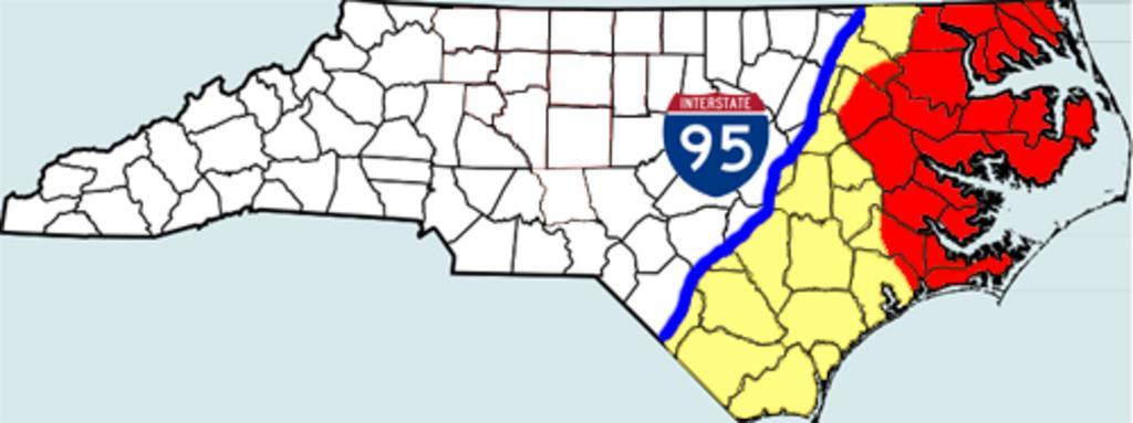
| Keywords: Innerbanksarea.png Using many examples at http //en wikipedia org/wiki/Talk Inner_Banks and http //en wikipedia org/wiki/Wikipedia Articles_for_deletion/Inner_Banks_ 282nd_nomination 29 I have made a map based on Piedmonttriadarea PNG image created by me of the Inner Banks area that is most accepted Red areas show the most commonly branded Inner Banks area Orange areas show where the Inner Banks term i sometimes used Interstate 95 marks the western border of the Inner Banks based in the Wikipedia Article Carteret County is not included because it is called and/or marketed as the Crystal Coast 2006-10-22 own assumed Gooday 1~commonswiki Maps of North Carolina | ||||