MAKE A MEME
View Large Image

| View Original: | India 1819-1909.svg (1200x1000) | |||
| Download: | Original | Medium | Small | Thumb |
| Courtesy of: | commons.wikimedia.org | More Like This | ||
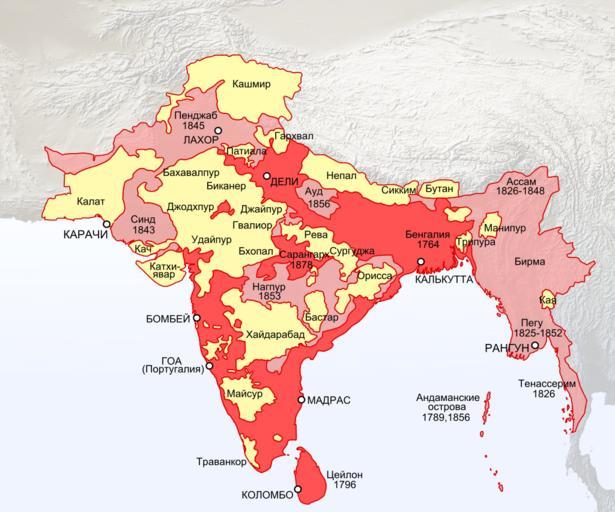
| Keywords: India 1819-1909.svg Expansion of the British Empire in India Indochina and Ceylon<br>Red by 1819 <br>Pink by 1909 direct administration <br>Yellow Princely states by 1909 own based on <br>Topo data from Natural Earth naturalearthdata com PD <br>Historical boundaries http //dsal uchicago edu/reference/schwartzberg/pager html object 093 1819 http //dsal uchicago edu/maps/gazetteer/images/gazetteer_frontcover jpg 2014-03-12 Retired electrician Maps_of_British_India Cc-zero | ||||