MAKE A MEME
View Large Image

| View Original: | GSENM_Brochure_Final_CYMK_Devils_Garden_circled.jpg (2198x1682) | |||
| Download: | Original | Medium | Small | Thumb |
| Courtesy of: | commons.wikimedia.org | More Like This | ||
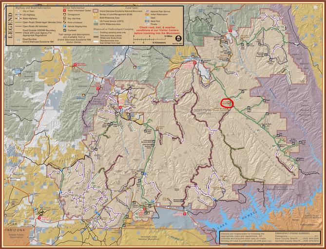
| Keywords: GSENM Brochure Final CYMK Devils Garden circled.jpg Bureau of Land Management BLM http //www blm gov/ut/st/en/fo/grand_staircase-escalante html website for Grand Staircase-Escalante National Monument GSENM Utah USA with the Devils Garden area circled in red PDF file converted to JPG format and edited by Brian W Schaller using the GNU Image Manipulation Program GIMP 2007-04-30 http //www blm gov/ut/st/en/fo/grand_staircase-escalante/Recreation/travel_brochure__ html Official park map for GSENM Bureau of Land Management BLM PD-USGov Uploaded with UploadWizard Devil's Garden Grand Staircase-Escalante National Monument Maps of protected areas of the United States ImageNote 1 1234 353 193 123 2198 1682 2 Escalante and visitor center ImageNoteEnd 1 ImageNote 2 555 491 213 412 2198 1682 2 Bryce Canyon National Park ImageNoteEnd 2 ImageNote 3 1946 289 182 241 2198 1682 2 Capitol Reef National Park ImageNoteEnd 3 ImageNote 4 779 664 76 93 2198 1682 2 Cannonville and visitor center ImageNoteEnd 4 ImageNote 5 1166 1393 126 95 2198 1682 2 Big Water and visitor center ImageNoteEnd 5 ImageNote 6 1988 662 146 207 2198 1682 2 Glen Canyon National Recreation Area ImageNoteEnd 6 ImageNote 7 2083 1127 95 107 2198 1682 2 Hole-in-the-Rock ImageNoteEnd 7 ImageNote 8 917 1561 185 95 2198 1682 2 Vermilion Cliffs National Monument ImageNoteEnd 8 ImageNote 9 2035 1416 137 90 2198 1682 2 Rainbow Bridge National Monument ImageNoteEnd 9 ImageNote 10 191 1427 160 98 2198 1682 2 Kanab and visitor center ImageNoteEnd 10 ImageNote 11 1475 650 115 95 2198 1682 1 Devils Garden ImageNoteEnd 11 | ||||