MAKE A MEME
View Large Image

| View Original: | Galicia1836.gif (658x806) | |||
| Download: | Original | Medium | Small | Thumb |
| Courtesy of: | commons.wikimedia.org | More Like This | ||
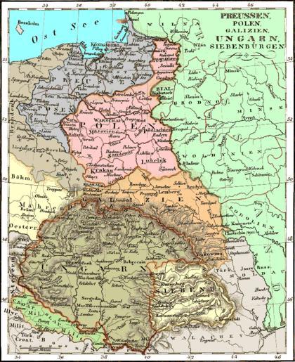
| Keywords: Galicia1836.gif This 1836 map of Eastern Europe shows Poland Kongresówka Prussia East Prussia West Prussia Posen Silesia Hungary Galicia and Bukovina Republic of Cracow Kraków Krakau Transylvania Vojvodina Serbia N Croatia Moldavia and Ukraine Budapest is shown as two cities Buda or Ofen and Pesth Gjör is called Raab Debrecen - Debreczin Pecs - Fünfkirchen Székesfehérvár - Stuhl Weissenburg Balaton - Platten See Bratislava - Presburg Szabadka/Subotica - Maria-Theresienstadt Sibiu - Hermanstadt Brasov - Kronstadt Cluj-Napoca - Clausenburg Timisoara - Temesvar Lwów/Lviv - Lemberg etc Source http //www rollintl com/roll/galicia htm PD-old 1836 maps Old maps of Congress Poland Old maps of the Kingdom of Galicia Maps of the history of Early Modern Romania Maps of the history of Transylvania Old maps of the history of Hungary Maps of the history of Slavonia Moldavia Maps of Wallachia Grand Principality of Transylvania Maps showing 19th-century history Old maps of Slovakia | ||||