MAKE A MEME
View Large Image

| View Original: | Delaware_Basin_map.PNG (1160x734) | |||
| Download: | Original | Medium | Small | Thumb |
| Courtesy of: | commons.wikimedia.org | More Like This | ||
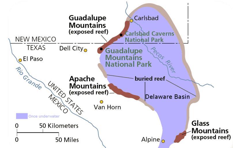
| Keywords: Delaware Basin map.PNG Delaware Basin ” a geologic depositional and structural basin in West Texas and southeastern New Mexico It is part of the larger Permian Basin itself contained within the Mid-Continent oil province Guadalupe Mountains National Park and Carlsbad Caverns National Park protect part of the basin unknown own National Park Service From pdf linked from http //www nps gov/gumo/naturescience/geologicformations htm Edited using the GIMP I place those edits in the public domain other versions PD-USGov Sedimentary basins Structural basins Geological maps of Texas Geology of New Mexico Basins of the United States Maps of Culberson County Texas Maps of Eddy County New Mexico Maps of Hudspeth County Texas Guadalupe Mountains 04 Carlsbad Caverns National Park 05 Maps of Guadalupe Mountains National Park 05 Pecos River West Texas 04 | ||||