MAKE A MEME
View Large Image
| View Original: | Corpus_christi_bay.png (780x556) | |||
| Download: | Original | Medium | Small | Thumb |
| Courtesy of: | commons.wikimedia.org | More Like This | ||
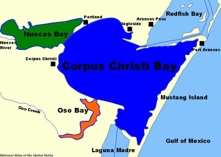
| Keywords: Corpus christi bay.png Corpus Christi Bay Map adapted from http //www nationalatlas gov/servlet/com esri esrimap Esrimap Name VBAtlas cmd ZOOMIN left 245970 34371825715 bottom -1923909 9941722269 right 296288 1912039362 top -1888476 3653526336 mWidth 802 mHeight 578 LonLat null bgoff T tabs T visLayers States LakesRivers U S Federal Government PD-USGov Nueces County Texas San Patricio County Texas | ||||