MAKE A MEME
View Large Image
| View Original: | CapeCodTowns.jpg (800x600) | |||
| Download: | Original | Medium | Small | Thumb |
| Courtesy of: | commons.wikimedia.org | More Like This | ||
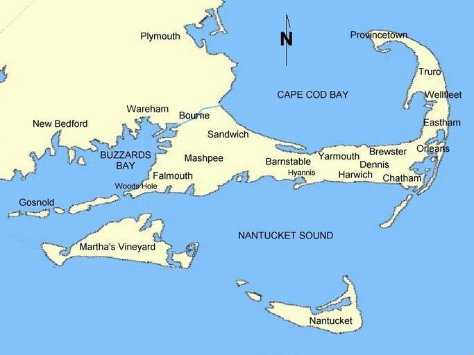
| Keywords: CapeCodTowns.jpg Map of Cape Cod town locations Drawn by uploader based on National Atlas U S Govt outline Released to public domain 2006-06-18 Own WT-shared OldPine wts Other fields Information field ucfirst location/i18n Cape Cod User at wikivoyage old WT-shared OldPine wts Original upload log wts page wts wikivoyage-old CapeCodTowns jpg 2006-06-22 00 09 http //wts wikivoyage-old org/wiki/user 3A 28WT-shared 29_OldPine WT-shared OldPine 800×600 64576 bytes <nowiki>Map of Cape Cod Town locations Drawn by uploader based on National Atlas outline Released to public domain Import from wikitravel org/shared </nowiki> 2006-06-18 20 04 http //wts wikivoyage-old org/wiki/user 3A 28WT-shared 29_OldPine WT-shared OldPine 800×600 64576 bytes <nowiki>Map of Cape Cod town locations Drawn by uploader based on National Atlas U S Govt outline Released to public domain Import from wikitravel org/shared </nowiki> Files by Wikivoyage user OldPine Maps of Cape Cod Travel maps of Massachusetts | ||||