MAKE A MEME
View Large Image

| View Original: | CA-25th.png (651x400) | |||
| Download: | Original | Medium | Small | Thumb |
| Courtesy of: | commons.wikimedia.org | More Like This | ||
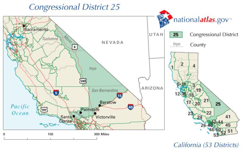
| Keywords: CA-25th.png California's 25th congressional district ” United States House of Representatives Located in eastern and Southern California http //nationalatlas gov/printable/congress html PD-USGov-Atlas Automatically converted to PNG The PNG crusade bot automatically converted this image to the more efficient PNG format The image was previously uploaded as CA-25th gif Previous file history 05 24 25 15 February 2007 UTC VitaleBaby Talk contribs 651x400 38 584 bytes <nowiki>http //nationalatlas gov/printable/congress html 15 56 09 12 September 2007 UTC Tom Talk contribs <nowiki> BadGIF </nowiki> 05 24 25 15 February 2007 UTC VitaleBaby Talk contribs <nowiki>http //nationalatlas gov/printable/congress html PD-USGov </nowiki> Original upload log page en wikipedia CA-25th png Upload date User Bytes Dimensions Comment 2007-10-18 00 31 00 PNG crusade bot 31999 651×400 <small><nowiki> http //nationalatlas gov/printable/congress html PD-USGov Automatically converted to PNG The PNG crusade bot automatically converted this image to the more efficient PNG format The image was previously </nowiki></small> PD-USGov Congressional district maps of California Maps of Inyo County California Maps of Los Angeles County California Maps of Mono County California Maps of San Bernardino County California | ||||