MAKE A MEME
View Large Image

| View Original: | Bridgeport_Covered_Bridge.jpg (964x676) | |||
| Download: | Original | Medium | Small | Thumb |
| Courtesy of: | commons.wikimedia.org | More Like This | ||
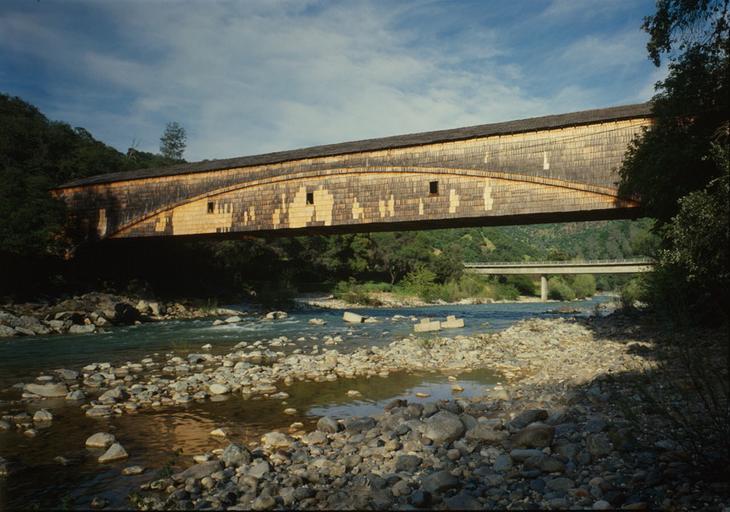
| Keywords: Bridgeport Covered Bridge.jpg The Bridgeport Covered Bridge and concrete Hwy 49 bridge beyond crossing the South Fork Yuba River view east ” in South Yuba River State Park The bridge is 230 feet 70 m long and is located in Bridgeport in the northern Sierra Nevada Nevada County California The bridge was originally constructed in 1862 and was part of the Virginia Turnpike Company Toll Road that served the northern mines and traffic to and from Virginia City and the Comstock Lode in Nevada Historical American Engineering Record ” Historic American Buildings Survey 'HABS-HAER' at LOC National Register of Historic Places Registered California Historical Landmark Bridgeport Covered Bridge http //www loc gov/pictures/item/ca1341 color 571974c/ File at Library of Congress Photo date 1984 Jet Lowe PD-USGov-Interior-HABS Original upload log en wikipedia Jay8g CommonsHelper page en wikipedia Bridgeport_Covered_Bridge jpg 2007-05-04 02 46 Scgatorfan 1024×742× 218562 bytes Bridgeport Covered Bridge South Yuba River State Park Bridgeport CA View Looking East Historical American Engineering Record Bridgeport Covered Bridge 1984 in California Concrete beam bridges in the United States | ||||