MAKE A MEME
View Large Image

| View Original: | Bowen,_Emanuel._Anatolia,_Syria._1747._(C).jpg (1302x1215) | |||
| Download: | Original | Medium | Small | Thumb |
| Courtesy of: | commons.wikimedia.org | More Like This | ||
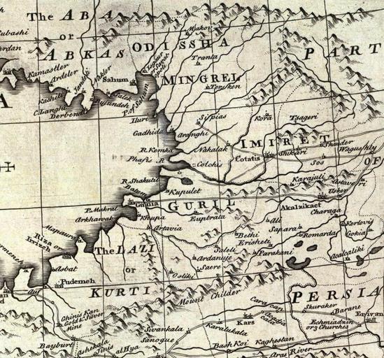
| Keywords: Bowen, Emanuel. Anatolia, Syria. 1747. (C).jpg en of Anatolia or Asia Minor with Syria and such other provinces of the Turkish Empire as border thereupon Laid down according to the best authorities regulated by astronomical observations By Eman Bowen London Printed for William Innys Richard Ware Aaron Ward J and P Knapton John Clarke T Longman and T Shewell Thomas Osborne Henry Whitridge M DCC XLVII Image Bowen Emanuel Anatolia Syria 1747 jpg Original from http //www davidrumsey com/luna/servlet/detail/RUMSEY~8~1~2582~270034 www davidrumsey com Creator Emanuel Bowen 1747 PD-old-100 ImageNote 1 440 122 414 193 1302 1215 2 Odissha Mingrel ImageNoteEnd 1 ImageNote 2 77 24 353 199 1302 1215 2 Tha AbA or Abkas ImageNoteEnd 2 ImageNote 3 304 809 280 245 1302 1215 2 The Lazi or Kurti ImageNoteEnd 3 ImageNote 4 560 653 262 93 1302 1215 2 Guril ImageNoteEnd 4 ImageNote 5 799 442 343 79 1302 1215 2 Imiret ImageNoteEnd 5 ImageNote 6 341 249 99 43 1302 1215 2 Sahum ImageNoteEnd 6 ImageNote 7 947 673 146 45 1302 1215 2 Akalzicact ImageNoteEnd 7 ImageNote 8 795 519 97 43 1302 1215 2 Cotatis ImageNoteEnd 8 ImageNote 9 420 523 110 41 1302 1215 2 Phasis R ImageNoteEnd 9 Old maps of the Black Sea Emanuel Bowen Maps by Emanuel Bowen 1747 maps Maps of the history of Abkhazia Old maps of the Caucasus 18th-century maps of Georgia Old maps of Turkey Old maps of Samegrelo History of Guria Old maps of Imereti David Rumsey Historical Map Collection Laz people | ||||