MAKE A MEME
View Large Image

| View Original: | Balkans 1265.jpg (748x900) | |||
| Download: | Original | Medium | Small | Thumb |
| Courtesy of: | commons.wikimedia.org | More Like This | ||
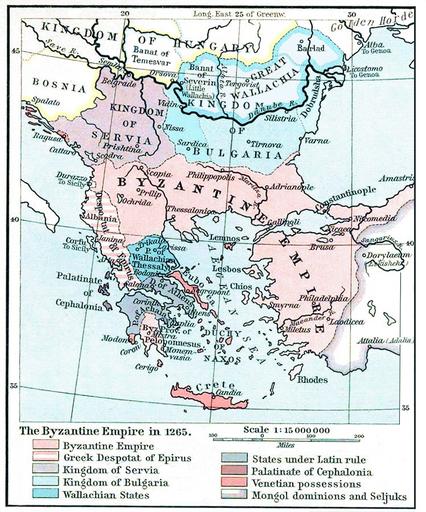
| Keywords: Balkans 1265.jpg States in the Balkans in the 13th century 1265 The Historical Atlas William R Shepherd 1911 ShepherdByzempire1265 jpg 2010-01-27 21 14 UTC ShepherdByzempire1265 jpg William R Shepherd derivative work Mladifilozof <span class signature-talk >talk</span> PD-old 150px original upload log This image is a derivative work of the following images File ShepherdByzempire1265 jpg licensed with PD-old 2009-07-12T16 26 21Z Alex D 1144x900 287421 Bytes whitened 2009-07-12T16 17 18Z Alex D 1144x900 287421 Bytes whitened 2009-07-12T16 12 47Z Alex D 1144x900 287421 Bytes whitened 2004-12-21T13 40 55Z Mschlindwein 1144x900 278685 Bytes Map The Byzantine Empire 1265 The Historical Atlas William R Shepherd 1911 Uploaded with derivativeFX Maps showing history by William R Shepherd Old maps of the Byzantine Empire Old maps of the Balkans Old maps of Serbia Old maps of Bulgaria Maps of the Kingdom of Serbia medieval Maps of the history of Bulgaria in the Middle Ages Maps of the history of Republika Srpska Maps of the history of Romania in the Middle Ages Romania in the 13th century Maps of Wallachia 1265 | ||||