MAKE A MEME
View Large Image

| View Original: | Atlas_Van_der_Hagen-KW1049B13_053-IAPONIA_REGNVM.jpeg (5500x4120) | |||
| Download: | Original | Medium | Small | Thumb |
| Courtesy of: | commons.wikimedia.org | More Like This | ||
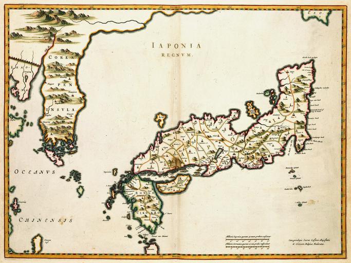
| Keywords: Atlas Van der Hagen-KW1049B13 053-IAPONIA REGNVM.jpeg of the Atlas Van der Hagen in the catalogue of the KB http //opc4 kb nl/DB 1/TTL 1/LNG EN/PPN PPN 353012750 Creator Martino_Martini Author Martino Martini Publisher Creator Joan Blaeu Author Martino Martini Publisher Creator Joan Blaeu credit line 1655 Deze kaart van Japan en Korea werd in 1655 gepubliceerd in de Atlas Sinensis van Joan Blaeu 1598-1673 Het bijzondere aan deze kaart samengesteld door de Italiaanse missionaris Martino Martini 1614-1661 is dat de omtrekken van Japan betrouwbaar zijn weergegeven terwijl ook Korea voor het eerst correct als een schiereiland is getekend Deze kaart was het prototype voor al de kaarten die in de 17de eeuw van dit gebied werden samengesteld Martino Martini s 1614-1661 map of Japan was to provide the most accurate picture of Japans general outlines for over a century It was copied extensively throughout the 17th century and replaced in the following centuries by maps that were in most respects inferior Martini included it in his atlas of China published by Joan Blaeu 1571-1638 His first-hand knowledge of the mainland enabled him to draw Korea correctly as a peninsula 42 x 56 cm exhibition history Institution Koninklijke Bibliotheek kopergravure Technique copper engraving KW1049B13_053 - Volume 1 Joan Blaeu - Martino Martini Information field Depicted locations Japan - Korea object history object type Kaart Map PD-old-100 place of creation Amsterdam place of discovery Source page at the http //resolver kb nl/resolve urn urn gvn KONB01 401 Geheugen van Nederland / Memory of the Netherlands website Koninklijke Bibliotheek IAPONIA REGNVM Uploaded with GWToolset Atlas Van der Hagen-KW1049B13_053-IAPONIA REGNVM http //resolver kb nl/resolve urn urn gvn KONB01 1049B13_053 size large Atlas van der Hagen | ||||