MAKE A MEME
View Large Image

| View Original: | Atlas_Van_der_Hagen-KW1049B10_004-SPITSBERGA.jpeg (5500x4322) | |||
| Download: | Original | Medium | Small | Thumb |
| Courtesy of: | commons.wikimedia.org | More Like This | ||
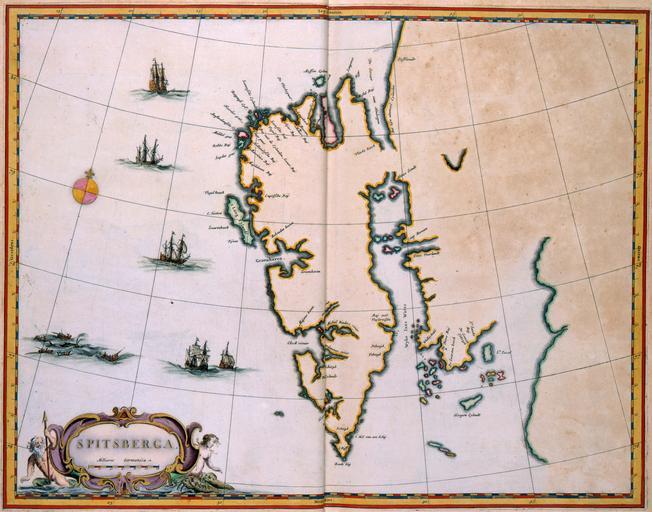
| Keywords: Atlas Van der Hagen-KW1049B10 004-SPITSBERGA.jpeg of the Atlas Van der Hagen in the catalogue of the KB http //opc4 kb nl/DB 1/TTL 1/LNG EN/PPN PPN 353012750 Publisher Creator Joan Blaeu Publisher Creator Joan Blaeu credit line 1662 Het eiland Spitsbergen werd in 1596 door Willem Barentsz ontdekt bij een poging om een noordoostelijke doorvaart naar Indië te vinden Na de ontdekking van het eiland vestigden de Nederlanders hier het walvisvangststation Smerenburg dat in 17de en 18de eeuw de belangrijkste uitvalsbasis voor Nederlandse walvisvaarders was Deze kaart van Spitsbergen werd in 1662 door Joan Blaeu 1598-1673 gepubliceerd in het eerste deel van zijn Atlas Maior The island Spitsbergen was discovered in 1596 by Willem Barentsz c 1550-1597 while searching for a north-eastern seaway to India After its discovery the Dutch established the whaling station Smerenburg that would become the most important station for the Dutch whalers in the 17th and 18th centuries This map of Spitsbergen was published in 1662 by Joan Blaeu 1598-1673 in the first volume of his Atlas Maior 38 x 49 cm exhibition history Institution Koninklijke Bibliotheek kopergravure Technique copper engraving KW1049B10_004 - Volume 1 Joan Blaeu - Willem Barentsz Information field Depicted locations Spitsbergen - Smerenburg object history object type Kaart Map PD-old-100 place of creation Amsterdam place of discovery Source page at the http //resolver kb nl/resolve urn urn gvn KONB01 4 Geheugen van Nederland / Memory of the Netherlands website Koninklijke Bibliotheek SPITSBERGA Uploaded with GWToolset Atlas Van der Hagen-KW1049B10_004-SPITSBERGA http //resolver kb nl/resolve urn urn gvn KONB01 1049B10_004 size large Atlas van der Hagen | ||||