MAKE A MEME
View Large Image

| View Original: | Atlas_Van_der_Hagen-KW1049B11_078-TETRACHIA_DUCATUS_GELDRIAE_RUREMONDANA_sive_HISPANICA.jpeg (5500x4549) | |||
| Download: | Original | Medium | Small | Thumb |
| Courtesy of: | commons.wikimedia.org | More Like This | ||
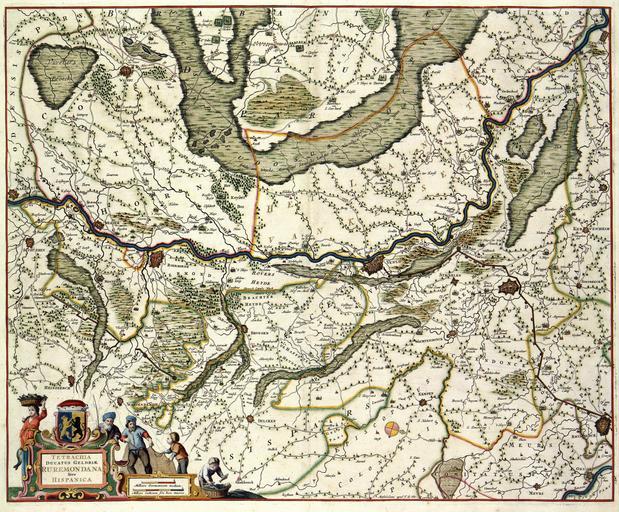
| Keywords: Atlas Van der Hagen-KW1049B11 078-TETRACHIA DUCATUS GELDRIAE RUREMONDANA sive HISPANICA.jpeg of the Atlas Van der Hagen in the catalogue of the KB http //opc4 kb nl/DB 1/TTL 1/LNG EN/PPN PPN 353012750 Publisher Creator Frederick de Wit Publisher Creator Frederick de Wit credit line na 1688 Deze kaart van het Kwartier Roermond van het Hertogdom Gelre werd aan het eind van de 17de eeuw uitgegeven door Frederik de Wit 1630-1706 De kaart is gebaseerd op een veel oudere kaart van de kartograaf Nicolaas van Geelkercken ca 1585-1656 Van Geelkercken maakte deze kaart in de dertiger jaren van de 17de eeuw voor de geschiedschrijving van Gelderland van Johan Isaksson Pontanus The map of the District Roermond of the duchy of Gelre was published at the end of the 17th century by Frederik de Wit 1630-1706 The map was based on a much older map from the hand of Nicolaas van Geelkercken c 1585-1656 Van Geelkercken produced the map in the thirties of the 17th century for the purpose of historiography of Gelderland by Johan Isaksson Pontanus 48 x 60 cm exhibition history Institution Koninklijke Bibliotheek kopergravure Technique copper engraving KW1049B11_078 - Volume 1 Frederik de Wit - Nicolaas van Geelkercken - Johan Isaksson Pontanus Information field Depicted locations Gelderland duchy - Roermond district - Netherlands object history object type Kaart Map PD-old-100 place of creation place of discovery Source page at the http //resolver kb nl/resolve urn urn gvn KONB01 216 Geheugen van Nederland / Memory of the Netherlands website Koninklijke Bibliotheek TETRACHIA DUCATUS GELDRIAE RUREMONDANA sive HISPANICA Uploaded with GWToolset Atlas Van der Hagen-KW1049B11_078-TETRACHIA DUCATUS GELDRIAE RUREMONDANA sive HISPANICA http //resolver kb nl/resolve urn urn gvn KONB01 1049B11_078 size large Atlas van der Hagen Johannes Isacius Pontanus | ||||