MAKE A MEME
View Large Image

| View Original: | Atlas_Van_der_Hagen-KW1049B13_090-TABVLA_MAGELLANICA_quà_Tierrae_del_fuego,_cum_celeberrimus_fretis_a_F._Magellano_et_I._Le_Maire_detectis_novissima_et_accuratissima_descriptio_exhibetur.jpeg (5500x4260) | |||
| Download: | Original | Medium | Small | Thumb |
| Courtesy of: | commons.wikimedia.org | More Like This | ||
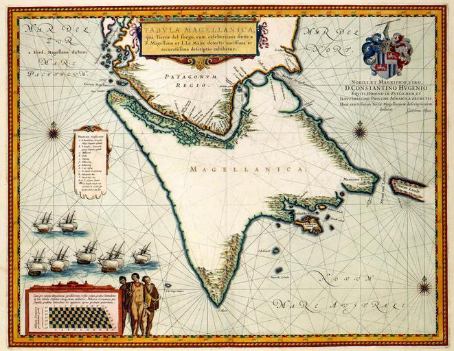
| Keywords: Atlas Van der Hagen-KW1049B13 090-TABVLA MAGELLANICA quà Tierrae del fuego, cum celeberrimus fretis a F. Magellano et I. Le Maire detectis novissima et accuratissima descriptio exhibetur.jpeg of the Atlas Van der Hagen in the catalogue of the KB http //opc4 kb nl/DB 1/TTL 1/LNG EN/PPN PPN 353012750 Publisher Creator Willem_Janszoon_Blaeu Publisher Creator Willem_Janszoon_Blaeu credit line 1635 In 1615-1617 ontdekten Jacob Le Maire 1585-1616 en Willem Cornelisz Schouten ca 1567-1625 ten zuiden de Straat van Magellanes een nieuwe zeeweg tussen de Atlantische en Grote Oceaan de Straat Le Maire Via deze nieuwe zeevaartweg kwam een alternatieve route voor de vaart op Indië beschikbaar waarbij het monopolie van de Verenigde Oost-Indische Compagnie op het bezeilen van de Straat van Magellanes kon worden omzeild Ondanks grote tegenwerking van de Compagnie en de Nederlandse overheid slaagde Willem Jansz Blaeu 1571-1638 er in om deze vondst in 1618 wereldkundig te maken Toen Blaeu in 1635 deze kaart van het zuidelijkste puntje van Zuid-Amerika publiceerde was de nieuwigheid van de ontdekking al lang verleden tijd en was de Straat le Maire een druk bevaren route ; Rechtsboven een opdracht van Willem Jansz Blaeu aan Constantijn Huygens In 1615-1617 Jacob Le Maire 1585-1616 and Willem Cornelisz Schouten c 1567-1625 discovered a new nautical route between the Atlantic and the Pacific Ocean south of the Strait of Magellanes the Strait Le Maire This new nautical route opened an alternative route to the Indies while the Strait of Magellanes which was dominated by the Dutch East India Company VOC could be avoided Though there was much opposition from the Company and the Dutch Government Willem Jansz Blaeu 1571-1638 succeeded in publishing this discovery in 1618 When Blaeu published this map of the southern most point of South-America in 1635 the curiosity was already over and the Strait le Maire a busy nautical route 41 x 54 cm exhibition history Institution Koninklijke Bibliotheek kopergravure Technique copper engraving KW1049B13_090 - Volume 1 Willem Jansz Blaeu - Jacob Le Maire - Willem Cornelisz Schouten - Constantijn Huygens Information field Depicted locations South-America - Strait Le Maire object history object type Kaart Map PD-old-100 place of creation Amsterdam place of discovery Source page at the http //resolver kb nl/resolve urn urn gvn KONB01 439 Geheugen van Nederland / Memory of the Netherlands website Koninklijke Bibliotheek TABVLA MAGELLANICA quà Tierrae del fuego cum celeberrimus fretis a F Magellano et I Le Maire detectis novissima et accuratissima descriptio exhibetur Uploaded with GWToolset Atlas Van der Hagen-KW1049B13_090-TABVLA MAGELLANICA quà Tierrae del fuego cum celeberrimus fretis a F Magellano et I Le Maire detectis novissima et accuratissima descriptio exhibetur http //resolver kb nl/resolve urn urn gvn KONB01 1049B13_090 size large Atlas van der Hagen Tierra del Fuego | ||||