MAKE A MEME
View Large Image

| View Original: | Atlas_Beudeker-C9E10_129_27X-KAARTE_van_het_verdronken_REIDERLAND,_tegenwoordigde_DOLLART._door_zorge_van_G-_OUTHOF_VAN_ABRAHAM_MAAS_geteekend-_B-_Ruyter_Sculp..jpeg (4447x4140) | |||
| Download: | Original | Medium | Small | Thumb |
| Courtesy of: | commons.wikimedia.org | More Like This | ||
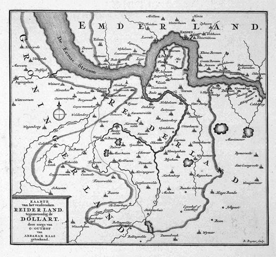
| Keywords: Atlas Beudeker-C9E10 129 27X-KAARTE van het verdronken REIDERLAND, tegenwoordigde DOLLART. door zorge van G- OUTHOF VAN ABRAHAM MAAS geteekend- B- Ruyter Sculp..jpeg accession number G Outhof Author G Outhof Publisher s n credit line nl 1720 Dit kaartje is een reconstructie van het Reiderland dat in de 15de en 16de eeuw werd overstroomd en dat sindsdien de Dollard vormt Het kaartje is afkomstig uit een boek van G Outhof uit 1720 waarin een overzicht wordt gegeven van de grootste overstromingen in Nederland sinds de Oudheid This map is a reconstruction of the Reiderland which had been flooded in the 15th and 16th centuries and formes the Dollard ever since The map was published in a book by G Outhof from 1720 which provides a general view of the major floodings in the Netherlands since Antiquity 18 x 20 cm exhibition history British Library Kopergravure Technique copper engraving C9E10 129_27X Information field Related persons Maas Abraham - Ruyter B - Outhof G Information field Depicted locations Netherlands - Groningen - Dollard object history object type Kaart Map PD-old-100 place of creation Groningen place of discovery Source page at the http //resolver kb nl/resolve urn urn gvn KONB01 578 Geheugen van Nederland / Memory of the Netherlands website British Library image Maps C 9 e 10 KAARTE van het verdronken REIDERLAND tegenwoordigde DOLLART door zorge van G OUTHOF VAN ABRAHAM MAAS geteekend B Ruyter Sculp Uploaded with GWToolset Atlas Beudeker-C9E10 129_27X-KAARTE van het verdronken REIDERLAND tegenwoordigde DOLLART door zorge van G OUTHOF VAN ABRAHAM MAAS geteekend B Ruyter Sculp http //resolver kb nl/resolve urn urn gvn KONB01 129_27X size large Atlas Beudeker | ||||