MAKE A MEME
View Large Image

| View Original: | Assessing_Potential_Impacts_on_Vegetation.jpg (3008x2000) | |||
| Download: | Original | Medium | Small | Thumb |
| Courtesy of: | www.flickr.com | More Like This | ||
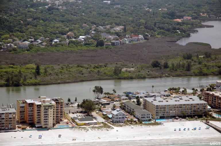
| Keywords: deepwaterhorizon oilspill usgs vegetation measurement research aerial outdoor landscape shore Florida's mangrove forests were hard hit by the uncommonly cold temperatures in January, 2010. Here, a dull brown swath of freeze-damaged mangroves cuts across the photograph, offering a stark contrast with green vegetation lining the nearby Intracoastal Waterway. By documenting freeze-related mangrove mortalities with aerial photographs, researchers will be better able to assess the impacts of oil on Florida's mangroves. Visit usgs.gov/deepwater_horizon for more information related to the USGS efforts in the Gulf of Mexico. Florida's mangrove forests were hard hit by the uncommonly cold temperatures in January, 2010. Here, a dull brown swath of freeze-damaged mangroves cuts across the photograph, offering a stark contrast with green vegetation lining the nearby Intracoastal Waterway. By documenting freeze-related mangrove mortalities with aerial photographs, researchers will be better able to assess the impacts of oil on Florida's mangroves. Visit usgs.gov/deepwater_horizon for more information related to the USGS efforts in the Gulf of Mexico. | ||||