MAKE A MEME
View Large Image

| View Original: | Antarctica_1912_edit.jpg (5676x4763) | |||
| Download: | Original | Medium | Small | Thumb |
| Courtesy of: | commons.wikimedia.org | More Like This | ||
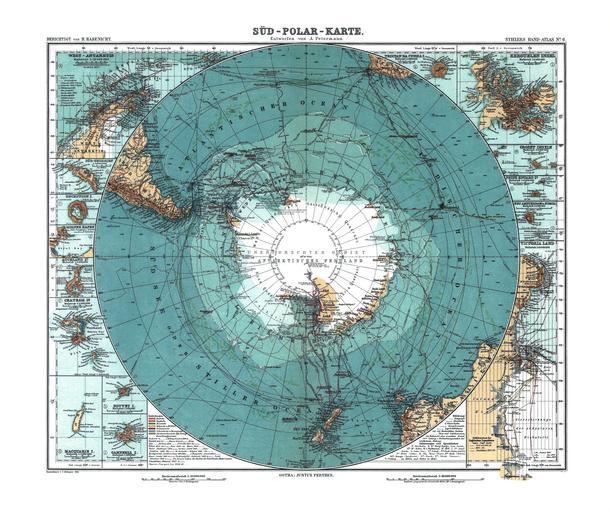
| Keywords: Antarctica 1912 edit.jpg mld Karte der Antarktis Ma√üstab ca 1 40 000 000 farbig 34 √ó 41 cm Map of Antarctica Scale ca 1 40 000 000 Col 34 √ó 41 cm Carte de l'Antarctique √©chelle 1 40Ý000Ý000<sup>e</sup> couleur 34 √ó 41 cm ◊û◊§◊™ ◊ê◊Ý◊ò◊®◊ò◊ô◊ß◊î ◊ß◊Ý◊î ◊û◊ô◊ì◊î 1 40 000 000 Mapa da Ant√°rctica Escala ca 1 40 000 000 Cor 34 √ó 41 cm Stieler Handatlas 9 von Grund aus neubearb und neugestochene Aufl 8 berichtigter Abdruck Verlag J Perthes Gotha 1912 LOC-map g9800 ct000774 Petermann A ; Habenicht H ; B√∂hmer C Petermann August Heinrich 1822-1878 119408953 Habenicht Hermann 1844-1917 116349174 B√∂hmer Carl 1878- 13254377X 1912 blemishes removed photofilter applied levels adjusted curves adjusted removed CA whitened border adjusted temperature File Sud_Polar_Karte jpg - alternative edit by User Alex D File Antarctica_1912 jpg - original jpg File Antarctica_1912 tif - edited and original tif PD-old Assessment Assessments c 2010 1 1 picture of the day 2010 11 19 Old maps of Antarctica 1912 in Antarctica 1912 maps Featured maps Featured pictures from the Library of Congress | ||||