MAKE A MEME
View Large Image

| View Original: | Antarctic Peninsula satellite image.jpg (1509x1846) | |||
| Download: | Original | Medium | Small | Thumb |
| Courtesy of: | commons.wikimedia.org | More Like This | ||
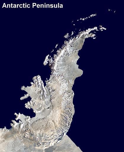
| Keywords: Antarctic Peninsula satellite image.jpg Antarctic Peninsula satellite image An orthographic projection of NASA's Blue Marble data set 1 km resolution global satellite composite MODIS observations of polar sea ice were combined with observations of Antarctica made by the National Oceanic and Atmospheric Administration ™s AVHRR sensor ”the Advanced Very High Resolution Radiometer Image was generated using a custom C program for handling the Blue Marble files with orthographic projection formulas from http //mathworld wolfram com/OrthographicProjection html MathWorld <br/> The black pixels are presumed to be due to missing data in the land/sea mask used in making the original Blue Marble image Antarctica_6400px_from_Blue_Marble jpg 2009-04-06 00 01 UTC Antarctica_6400px_from_Blue_Marble jpg Dave Pape derivative work Anna Frodesiak <span class signature-talk >talk</span> Cropped out Antarctic Peninsula from main image Anna Frodesiak Antarctica_6400px_from_Blue_Marble jpg Anna Frodesiak original upload log This image is a derivative work of the following images File Antarctica_6400px_from_Blue_Marble jpg licensed with PD-user 2006-10-05T14 21 53Z Davepape 6400x6400 3472802 Bytes <nowiki>touched up part with missing data</nowiki> 2006-10-05T07 49 09Z Davepape 6400x6400 3472752 Bytes <nowiki> Antarctica An orthographic projection of NASA's Blue Marble data set 1 km resolution global satellite composite MODIS observations of polar sea ice were combined with observa</nowiki> Uploaded with derivativeFX NASA MODIS images of Antarctica Satellite pictures of peninsulas Files by User Anna Frodesiak Blue Marble Next Generation images Antarctic Peninsula | ||||