MAKE A MEME
View Large Image

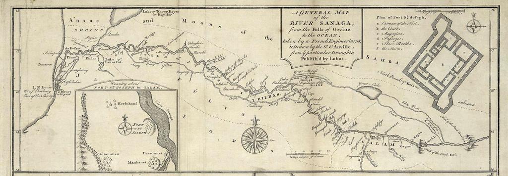
| View Original: | AMH-8162-KB_Map_of_the_mouth_of_the_Senegal_River_and_a_floorplan_of_Fort_St._Joseph_in_Galam.jpg (2400x834) | |||
| Download: | Original | Medium | Small | Thumb |
| Courtesy of: | commons.wikimedia.org | More Like This | ||
| Keywords: AMH-8162-KB Map of the mouth of the Senegal River and a floorplan of Fort St. Joseph in Galam.jpg Artwork nl Kaart van de monding van de rivier Senegal en een plattegrond van fort St Joseph in Galam nl Kaart van de monding van de rivier Senegal en twee plattegronden van fort St Joseph in Galam A General Map of the River Sanaga; from the Falls of Govina to the Ocean Country about fort St Joseph in Galam Plan of Fort St Joseph Legenda a-f en Map of the mouth of the Senegal River and two plans of Fort St Joseph in Galam A General Map of the River Sanaga; from the Falls of Govina to the Ocean Country about fort St Joseph in Galam Plan of Fort St Joseph Key a-f Atlas of Mutual Heritage kb http //www atlasofmutualheritage nl/en/object/ id 8162 Source at the Atlas of Mutual Heritage en Subjects chart / map / plan compass / dial banderole / cartouche / ornamentation fortification building nl Onderwerpen plattegrond / kaart kompas / windroos banderol / cartouche / versiering vesting gebouw en Post this image is related to a WIC trading post called http //www atlasofmutualheritage nl/en/post/ id 1904 St Louis Inscription A General Map of the River Sanaga; from the Falls of Govina to the Ocean author G Child Sculpt signatuur onder andere kaart op dezelfde pagina nl 1745 Creator d' Anville Creator G Child nl Anoniem / Anonymous uitgever d' Anville landmeter / kaartenmaker G Child graveur / etser en Anoniem / Anonymous publisher d' Anville land surveyor / mapmaker G Child engraver / etcher Institution Koninklijke Bibliotheek nl gravure op papier en engraving on paper Size cm 10 28 accession number 3032 B 10 to p 45 PD-Art-100 1745 | ||||