MAKE A MEME
View Large Image

| View Original: | AMH-7926-KB_View_of_Table_Bay_featuring_a_map_of_the_bay_and_the_fort.jpg (1773x2400) | |||
| Download: | Original | Medium | Small | Thumb |
| Courtesy of: | commons.wikimedia.org | More Like This | ||
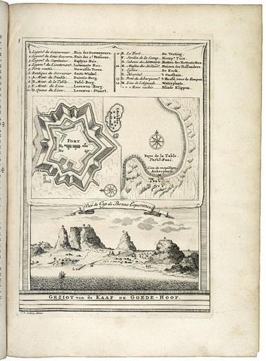
| Keywords: AMH-7926-KB View of Table Bay featuring a map of the bay and the fort.jpg Artwork nl Gezicht op de Tafelbaai met een plattegrond van de baai en het fort nl Gezicht op de Tafelbaai met een plattegrond van de baai en het fort Gezigt van de Kaap de Goede-Hoop Vuë du Cap de Bonne Esperance Legenda 1-14 en A-M en View of Table Bay featuring a map of the bay and the fort Gezigt van de Kaap de Goede-Hoop Vuë du Cap de Bonne Esperance Key 1-14 en A-M Atlas of Mutual Heritage kb http //www atlasofmutualheritage nl/en/object/ id 7926 Source at the Atlas of Mutual Heritage en Subjects chart / map / plan survey / view fortification building banderole / cartouche / ornamentation compass / dial key house ship / vessel anchorage / pier / harbour nl Onderwerpen plattegrond / kaart overzicht / aanzicht vesting gebouw banderol / cartouche / versiering kompas / windroos legenda huis / woonhuis schip / vaartuig rede / haven / pier en Post this image is related to a VOC trading post called http //www atlasofmutualheritage nl/en/post/ id 320 Cape Town Inscription Gezigt van de Kaap de Goede-Hoop author J v Schley driex nl 1747 Creator Pierre d' Hondt Creator Jacobus van der Schley nl Pierre d' Hondt uitgever Jacobus van der Schley direxit en Pierre d' Hondt publisher Jacobus van der Schley direxit Institution Koninklijke Bibliotheek nl gravure op papier en engraving on paper Size cm 18 5 13 5 accession number 693 C 6 dl II na p 248 PD-Art-100 Maps of the Dutch East India Company - South Africa 1747 | ||||