MAKE A MEME
View Large Image

| View Original: | AMH-6699-KB Map of All Saints Bay.jpg (2400x1895) | |||
| Download: | Original | Medium | Small | Thumb |
| Courtesy of: | commons.wikimedia.org | More Like This | ||
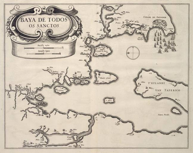
| Keywords: AMH-6699-KB Map of All Saints Bay.jpg Artwork nl Kaart van de Allerheiligenbaai nl Kaart van de Allerheiligenbaai Baya de Todos os Sanctos Op de kaart zijn de suikermolens aangeduid Een mogelijk Nederlandse vloot vaart de baai bij Salvador binnen en Map of All Saints Bay Baya de Todos os Sanctos The sugar mills are indicated on the map A fleet possibly Dutch sails into the bay near Salvador Atlas of Mutual Heritage kb http //www atlasofmutualheritage nl/en/object/ id 6699 Source at the Atlas of Mutual Heritage en Subjects compass / dial anchorage / pier / harbour church / parsonage house fence / kraal chart / map / plan banderole / cartouche / ornamentation ship / vessel building nl Onderwerpen kompas / windroos rede / haven / pier kerk / pastorie huis / woonhuis omheining / kraal plattegrond / kaart banderol / cartouche / versiering schip / vaartuig gebouw en Post this image is related to a WIC trading post called http //www atlasofmutualheritage nl/en/post/ id 1052 Salvador Inscription Baya de Todos os Sanctos nl circa 1644 Creator B Elsevier Creator I Elsevier nl B Elsevier uitgever I Elsevier uitgever Anoniem / Anonymous landmeter / kaartenmaker en B Elsevier publisher I Elsevier publisher Anoniem / Anonymous land surveyor / mapmaker Institution Koninklijke Bibliotheek nl gravure op papier en engraving on paper Size cm 36 28 accession number 40 E 7 na p 10 PD-Art-100 Maps of the West-Indische Compagnie 1644 | ||||