MAKE A MEME
View Large Image

| View Original: | Ägypten_Dar_Fur_und_Abessinien.jpg (2832x3488) | |||
| Download: | Original | Medium | Small | Thumb |
| Courtesy of: | commons.wikimedia.org | More Like This | ||
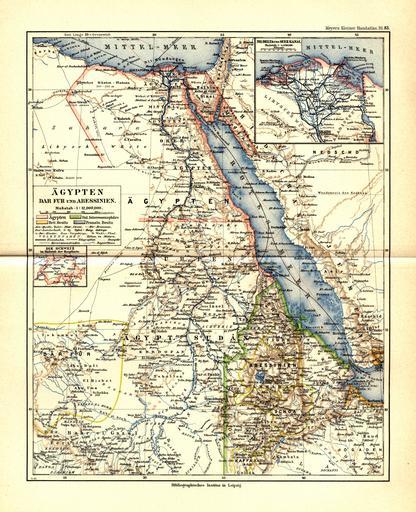
| Keywords: Ägypten Dar Fur und Abessinien.jpg Map of Egypt and Sudan in 1892 DATA VINTAGE Map circa 1892 LAST FILE EDIT DATE 6/24/2005 GEOGRAPHIC AREA NAME S Africa TECHNICAL INFORMATION - GENERAL SPATIAL REFERENCE TYPE Bitmap/Raster Image DATA FILE/COVER NAME S 83_g1019m4_1892_th jpg 83_g1019m4_1892_m jpg 83_g1019m4_1892_l jpg DATA FILE S FORMAT Scanned map/JPEG TECHNICAL INFORMATION - SPATIAL REGISTERED TO BASE Not Applicable COORDINATE SYSTEM Latitude/Longitude PLANAR DISTANCE/MAP UNITS Unknown HORIZONTAL ACCURACY Not Applicable TECHNICAL INFORMATION - ATTRIBUTE/NON-SPATIAL ATTRIBUTE DATA OVERVIEW Map of Egypt and Sudan circa 1892 SOURCE and PROCESSING INFORMATION SOURCE S OVERVIEW In Meyers kleiner Hand-Atlas Mit Benutzung der Kartenmaterials aus Meyers Konversations-Lexikon zusammenstellt in 100 Kartenblättern und 9 Textbeilagen Leipzig Verlag des Bibliographischen Instituts 1892 PROCESSING STEPS/NOTES Image scanned at 600 dpi for thumbnail Tiff files at 600 dpi are available through the map library but not online Please email The large image was created in Adobe Photoshop at 300 dpi and the medium image was created by reducing the size of the large image AVAILABILITY and STATUS INFORMATION AVAILABILITY NOTES/FEES Available to public at no cost ARCHIVE/TRANSFER FILE NAME 83_g1019m4_1892_th jpg 83_g1019m4_1892_m jpg 83_g1019m4_1892_l jpg ARCHIVE/TRANSFER FILE TYPE Not a Compressed File PD-Art Old maps of Sudan Old maps of Ethiopia Old maps of Egypt Egypt in the 1890s Old maps of South Sudan Artworks missing infobox template Egyptian Halayeb Triangle in 1892 | ||||