MAKE A MEME
View Large Image
| View Original: | 1897_Brooklyn_map.jpg (4134x3084) | |||
| Download: | Original | Medium | Small | Thumb |
| Courtesy of: | commons.wikimedia.org | More Like This | ||
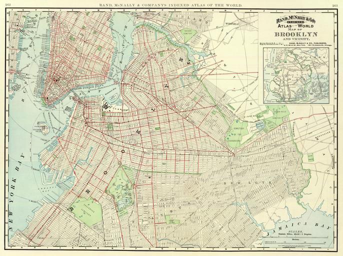
| Keywords: 1897 Brooklyn map.jpg This is a map of Brooklyn and vicinity published by Rand McNally in 1897 as part of their Atlas of the World The http //www davidrumsey com/ David Rumsey Collection scanned it PD-Art 1890s maps of New York City 1897 in New York City History of Brooklyn David Rumsey Historical Map Collection 1897 maps Artworks missing infobox template | ||||