MAKE A MEME
View Large Image

| View Original: | 1873_Beers_Map_of_Riverhead,_Suffolk_County,_Long_Island_-_Geographicus_-_Riverhead-beers-1873.jpg (4000x2655) | |||
| Download: | Original | Medium | Small | Thumb |
| Courtesy of: | commons.wikimedia.org | More Like This | ||
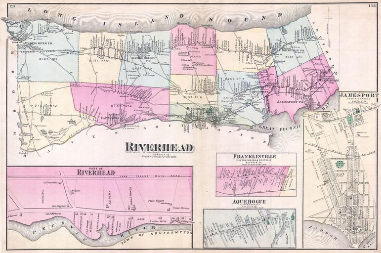
| Keywords: 1873 Beers Map of Riverhead, Suffolk County, Long Island - Geographicus - Riverhead-beers-1873.jpg This scarce and large hand colored map depicts the town of Riverhead Long Island New York Map depicts the populous cities and towns surrounding Riverhead including Franlkinville Aquebogue Jamesport Wading River Baiting Hollow Northville and Calverton Includes detailed insets of Franklinville Jamesport and Aquebogue Southampton lies to the south The extraordinary detail of this map down to individual households with family names make it a fascinating study for the family researcher or historian 1873 undated Size in 22 14 5 object history credit line accession number Riverhead-beers-1873 <i>Atlas of Long Island New York From Recent Actual Surveys and Records Under the Superintendence of F W Beers </i> 1873 First Edition Geographicus-source PD-art File Riverhead Suffolk Co - Part of Riverhead - Franklinville Ts of Riverhead and Southold Suffolk Co - Aquebogue Tn of Riverhead Suffolk Co - Jamesport Tn of Riverhead Suffolk Co NYPL1527347 tiff Beers maps of Long Island published in 1873 Maps of Suffolk County New York Town of Riverhead New York | ||||