MAKE A MEME
View Large Image

| View Original: | 1864_Johnson's_Map_of_Japan_(Nippon,_Kiusiu,_Sikok,_Yesso_and_the_Japanese_Kuriles)_-_Geographicus_-_Japan-j-64.jpg (3000x2478) | |||
| Download: | Original | Medium | Small | Thumb |
| Courtesy of: | commons.wikimedia.org | More Like This | ||
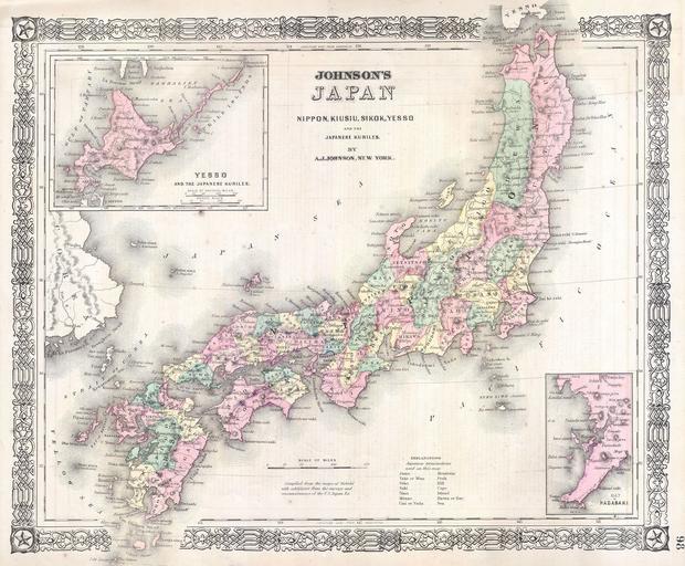
| Keywords: 1864 Johnson's Map of Japan (Nippon, Kiusiu, Sikok, Yesso and the Japanese Kuriles) - Geographicus - Japan-j-64.jpg This is a beautifully hand colored 1864 lithograph map of the Japan There are insets of the bay of Nagasaki and Yesso Hokkaido and the Japanese Kuriles Compiled by A J Johnson from the map of Siebold with additions from the surveys and reconnaissances of the U S Japan Expedition Prepared for issue as plate no 98 in the 1864 edition of Johnson's Atlas 1864 undated Size in 16 13 object history credit line accession number Japan-j-64 <i>Johnson's New Illustrated Steel Plate Family Atlas</i> 1864 edition Geographicus-source PD-old-100 Maps by Alvin Jewett Johnson 1864 maps Old maps of Japan Old maps of the Sea of Japan | ||||