MAKE A MEME
View Large Image

| View Original: | 1863_"Cassell's_Dispatch_Atlas"_Map_of_Taiwan_-_Formosa_^_the_Hainan_Coast_of_China_-_Geographicus_-_CoastofChina-dispatch-1863.jpg (2148x3000) | |||
| Download: | Original | Medium | Small | Thumb |
| Courtesy of: | commons.wikimedia.org | More Like This | ||
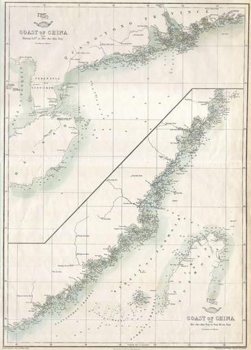
| Keywords: 1863 "Cassell's Dispatch Atlas" Map of Taiwan - Formosa ^ the Hainan Coast of China - Geographicus - CoastofChina-dispatch-1863.jpg Artwork en This hand colored map is a lithographic transfer dating to 1863 by London cartographer Edward Weller Depicts the coast of China including the Strait of Formosa and most of Taiwan or Formosa Island Depth soundings indicated in fathoms along major shipping routes and throughout the map Originally part of the Weekly Dispatch Atlas Publisher Edward Weller 18 “1884 was a cartographer and engraver based in London His best known work appears in Cassell ™s Weekly Dispatch Atlas published in monthly segments for subscribers of the Weekly Dispatch newspaper This collection of maps eventually grew to include much of the known world Published in various editions from 1855 through the early 1880s 1863 Size in 17 12 object history credit line accession number CoastofChina-dispatch-1863 Geographicus-source PD-art 1863 maps 19th-century maps of China Old maps of Taiwan Taiwan Strait | ||||